洛县Malibu「Bryson Fire」扩至至少40英亩 KAN-U017分区发布疏散令
Malibu(Malibu)——10月15日下午,洛杉矶县Malibu以北、恩西纳尔峡谷路(Encinal Canyon Road)与穆赫兰德公路(Mulholland Highway)一带燃起灌木野火,洛县消防局将其命名为「Bryson Fire」。据县消防官员的通报,火情于下午4时30分许在恩西纳尔峡谷路400号街区一带被报告,起火点临近洛县基尔帕特里克营(Camp Kilpatrick)少年惩教设施。在Santa Ana强风助推下,火势约15分钟内由约半英亩扩至5英亩,半小时内达约20英亩;截至傍晚6时已烧逾35英亩,县消防官员随后表示,过火面积至少达40英亩,主火头前方还出现多处风吹飞火。Malibu市政府下午5时06分发布紧急警报,证实消防部门正在该路口一带处置山火,并提示居民为可能的疏散做好准备。
疏散方面,洛县已对KAN-U017分区发布疏散令,要求区内居民立即撤离;对LEO-U015、MAL-C113、MAL-C114与SYC-U016四个分区发布疏散警告。相关区域覆盖Malibu西部大片山地与海岸一带,向西最远至利奥·卡里略州立公园(Leo Carrillo State Park)。县消防局已增派地面队伍与空中力量扑救,Ventura County消防局派出设备与人员到场增援;Ventura County方面下午5时许表示,火势暂未对该县居民构成威胁,烟尘在该县境内可见。
截至发稿,洛县消防局尚未公布控制率;现场初步报告显示,暂无建筑受到威胁,亦无人员伤亡报告,起火原因尚未确定。加州消防局(Cal Fire)尚未为这场火建立事件专页,本篇面积与疏散数字以洛县消防局官员发布的口径为准,居民可通过Alert LA County与Genasys Protect查询所在分区的疏散状态。
背景方面,这场火燃起时,Malibu中西部正处于公共安全预防性断电(PSPS)之下:南加爱迪生公司(SCE)约于下午4时切断当地供电,部分交通信号灯受到影响;全南加目前有逾6.3万户处于PSPS断电中,其中洛杉矶与Ventura两县近5.8万户。国家气象局对洛杉矶、Ventura等县发布的红旗警告持续至周六(10月17日)晚8时,山区阵风可达每小时70英里。当日,洛县境内还先后发生阿祖萨「Peak Fire」等多起灌木火,消防力量多线作战。
(资料来源:洛杉矶县消防局官员通报(经FOX 11、《纽约邮报》、《Ventura County星报》报道);Malibu市政府官方警报中心2026年10月15日17:06紧急警报)
Malibu Bryson Fire Grows to at Least 40 Acres; Evacuation Order Issued for Zone KAN-U017
MALIBU — A brush fire broke out on the afternoon of October 15 in the hills north of Malibu in Los Angeles County, near Encinal Canyon Road and Mulholland Highway, and was named the Bryson Fire by the County Fire Department. According to county fire officials, the fire was reported around 4:30 p.m. in the 400 block of Encinal Canyon Road, close to the county's Camp Kilpatrick juvenile detention facility. Driven by strong Santa Ana winds, it grew from about half an acre to five acres within roughly 15 minutes and to about 20 acres within half an hour. By 6 p.m. it had burned more than 35 acres, and fire officials said the total had reached at least 40 acres, with wind-driven spot fires erupting ahead of the main blaze. At 5:06 p.m., the City of Malibu issued an emergency alert confirming that fire crews were responding at the intersection and urging residents to be prepared for potential evacuations.
On evacuations, Los Angeles County has issued an evacuation order for zone KAN-U017 and evacuation warnings for zones LEO-U015, MAL-C113, MAL-C114 and SYC-U016, covering a broad swath of western Malibu extending west to Leo Carrillo State Park and the coast. The County Fire Department has dispatched additional ground crews and aircraft, and the Ventura County Fire Department has sent equipment and personnel to assist. Ventura County authorities said shortly after 5 p.m. that the fire did not pose a threat to their residents, though smoke was visible across the county line.
As of publication, the County Fire Department had not announced a containment figure. Initial reports from crews at the scene indicated that no structures were threatened and no injuries had been reported; the cause has not been determined. Cal Fire has not yet set up an incident page for this fire, so the acreage and evacuation details in this report follow figures released by Los Angeles County fire officials; residents can check their zone status through Alert LA County and Genasys Protect.
The fire erupted while central and western Malibu were under a Public Safety Power Shutoff (PSPS): Southern California Edison cut power to the area around 4 p.m., affecting traffic signals. More than 63,000 customers across Southern California are under PSPS shutoffs, including almost 58,000 in Los Angeles and Ventura counties. The National Weather Service's Red Flag Warning for the region remains in effect through 8 p.m. Saturday, with mountain gusts up to 70 mph. The Bryson Fire is one of several brush fires that erupted across Los Angeles County on Thursday, including the Peak Fire in Azusa.
(Sources: Los Angeles County fire officials, via FOX 11, the New York Post and the Ventura County Star; City of Malibu Alert Center emergency alert, 5:06 p.m., Oct. 15, 2026)
来源:GSM·美国(原文链接)
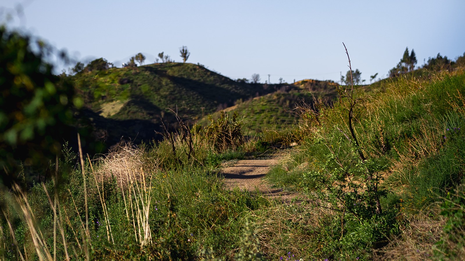
图片来源:图:起火地点马里布以北恩西纳尔峡谷一带的灌木山坡(资料照片)。美国国家公园管理局圣莫尼卡山国家休闲区摄,公共领域,取自维基共享资源。File photo: brush-covered hills in Encinal Canyon north of Malibu, where the Bryson Fire is burning. Photo by the U.S. National Park Service, Santa Monica Mountains National Recreation Area, public domain, via Wikimedia Commons.
GSM Global · 本篇英文版 English edition of this story
- 2026-10-15 18:18洛县Malibu「Bryson Fire」扩至至少40英亩 KAN-U017分区发布疏散令本篇
- 2026-10-15 18:44跟进:Malibu「Bryson Fire」扩至80英亩 疏散警告增至10个分区
- 2026-10-15 22:17跟进:Malibu「Bryson Fire」据报扩至约200英亩 红十字会在阿古拉高中开设避难所
- 2026-10-16 20:50跟进:Malibu「Bryson Fire」控制率升至39% 过火面积测绘修正为146.2英亩
- 2026-10-17 09:19跟进:Malibu「Bryson Fire」控制率升至52% 过火面积仍约147英亩
- 2026-10-17 19:21跟进:Malibu「Bryson Fire」疏散令与警告全部解除 道路重开 两处庇护点关闭
- 2026-10-17 22:40综合:南加四场山火全部受控推进 Henderson控制率升至50% Norte疏散令全解
- 2026-10-18 12:25跟进:Malibu「Bryson Fire」控制率升至68% 过火面积仍约147英亩
- 2026-10-18 22:51跟进:Malibu「Bryson Fire」控制率升至74% 过火面积仍约147英亩
- 2026-10-19 08:29跟进:Malibu「Bryson Fire」控制率升至83% 过火面积仍为147英亩
- 2026-10-20 10:23跟进:Malibu「Bryson Fire」已全面控制 过火面积约146英亩