雨季前盘点加州水库蓄水:沙斯塔湖满五成、奥罗维尔湖低于历年平均,圣路易斯高出平均逾四成
加州水资源部(California Department of Water Resources,DWR)下属加州数据交换中心(CDEC)11月6日发布的每日水库蓄水汇总显示,截至11月5日午夜,全州主要水库处于冬季雨季到来前的季节性低位。全州最大的沙斯塔湖(Shasta Lake)蓄水225.8万英亩-英尺、为库容的50%;奥罗维尔湖(Lake Oroville)蓄水145.5万英亩-英尺、为库容的42%,仅为历年同期平均的81%。新水年自10月1日开始已一个多月,各水库在夏秋用水季之后的水量,要等冬季风暴与 Sierra 积雪来补充。
北部两大水库一低一稳。沙斯塔湖库容455.2万英亩-英尺,当前蓄水225.8万英亩-英尺,为历年同期平均的93%,低于去年同期的255.5万英亩-英尺(当时为库容的56%)。奥罗维尔湖库容342.5万英亩-英尺,蓄水145.5万英亩-英尺、为历年同期平均的81%,比去年同期的180.9万英亩-英尺少了约35万英亩-英尺。同在北部的 Trinity 湖蓄水163.0万英亩-英尺、为库容的67%、达历年同期平均的115%;Whiskeytown 湖为库容的91%、达平均的104%。
中部与 Sierra 西坡水库多数接近或高于平均。Folsom 湖蓄水36.7万英亩-英尺、为库容的38%、历年同期平均的89%,低于去年同期的41.8万英亩-英尺。New Melones 水库蓄水150.7万英亩-英尺、为库容的63%、平均的117%;Don Pedro 水库蓄水147.2万英亩-英尺、为库容的73%、平均的110%;McClure 湖蓄水50.2万英亩-英尺、为库容的49%、平均的115%;Millerton 湖蓄水22.5万英亩-英尺、为库容的43%、与历年同期平均基本持平(99%)。相对偏低的是 Pine Flat 水库:蓄水18.6万英亩-英尺、仅为库容的19%、历年同期平均的66%,去年同期为26.9万英亩-英尺。Isabella 湖为库容的24%、平均的98%。
San Luis 水库是主要水库中相对水位最高的一个:蓄水134.1万英亩-英尺、为库容的66%、达历年同期平均的143%,且高于去年同期的106.9万英亩-英尺。这座州与联邦合营的离河水库靠抽引三角洲来水蓄存。南加州与沿海供水水库普遍不低:Castaic 湖蓄水27.2万英亩-英尺、为库容的84%、平均的108%;Pyramid 湖为库容的88%、平均的96%;Perris 湖为库容的89%、平均的126%;Cachuma 湖为库容的83%、平均的133%。Berryessa 湖蓄水132.1万英亩-英尺、为库容的82%、平均的117%。
本水年开局偏干。CDEC 同日发布的降水指数显示,北部 Sierra 地区本季至今降水0.71英寸、仅为历年同期平均的19%,明显低于去年同期的88%;南部 Sierra 为平均的66%,Tulare 流域为平均的105%。Redding、Sacramento、旧金山、洛杉矶等地多个测站10月1日至今的累计降水为零。积雪方面,全州积雪含水量目前为0.4英寸、为历年同期平均的4%、仅相当于4月1日平均峰值的1%,积雪季才刚刚开始。
多数主要水库蓄水低于去年同期,主要是因为去年开局偏湿、对比基数较高;与历年同期平均相比,多数水库处于平均的八成至一成二之间,属雨季前的正常开局。需要留意的是奥罗维尔湖与 Pine Flat 相对平均偏低,以及北部降水至今只有平均的19%。接下来各水库能补进多少水,取决于12月至次年3月冬季风暴的强度与 Sierra 积雪的累积——积雪春季融水是加州下半年供水的主要来源之一。
现有水库之外,加州正在增加新的蓄水能力:加州水资源委员会(State Water Resources Control Board)近日批准 Sites 水库取水许可,这座150万英亩-英尺的新水库通过关键关口,许可的具体条款随后公布。
关联:加州批准 Sites 水库取水许可:150万英亩-英尺新水库过关键关口
关联:跟进:Sites水库许可条款公布 引水限11月至6月中旬、只取富余水
(来源:加州水资源部)
California Reservoirs Ahead of the Rainy Season: Shasta Half Full, Oroville Below Average, San Luis More Than 40 Percent Above Average
California's major reservoirs are sitting at their seasonal pre-rainy-season lows, according to the Daily Reservoir Storage Summary released on November 6 by the California Data Exchange Center (CDEC) of the California Department of Water Resources (DWR), with data as of midnight on November 5. Shasta Lake, the state's largest reservoir, held 2,257,722 acre-feet, or 50 percent of capacity. Lake Oroville held 1,455,250 acre-feet, or 42 percent of capacity — just 81 percent of its average for this date. The new water year began on October 1, and the water drawn down over the summer and fall irrigation season will have to be replaced by winter storms and the Sierra snowpack.
In the north, Shasta Lake, with a capacity of 4,552,000 acre-feet, stood at 93 percent of its average for the date, below the 2,555,469 acre-feet (56 percent of capacity) it held a year ago. Lake Oroville, capacity 3,424,753 acre-feet, was at 81 percent of average, about 354,000 acre-feet less than the 1,809,262 acre-feet recorded on the same date last year. Trinity Lake held 1,629,764 acre-feet, 67 percent of capacity and 115 percent of average, while Whiskeytown Lake stood at 91 percent of capacity and 104 percent of average.
Most reservoirs in the central part of the state and along the western Sierra slope were near or above average. Folsom Lake held 367,386 acre-feet, 38 percent of capacity and 89 percent of average, down from 417,569 acre-feet a year ago. New Melones Reservoir held 1,507,159 acre-feet, 63 percent of capacity and 117 percent of average; Don Pedro Reservoir held 1,472,235 acre-feet, 73 percent of capacity and 110 percent of average; Lake McClure held 501,991 acre-feet, 49 percent of capacity and 115 percent of average; and Millerton Lake held 224,816 acre-feet, 43 percent of capacity and 99 percent of average, essentially even with its historical norm. The low outlier was Pine Flat Reservoir, at 185,708 acre-feet — only 19 percent of capacity and 66 percent of average, down from 268,933 acre-feet a year ago. Lake Isabella stood at 24 percent of capacity and 98 percent of average.
San Luis Reservoir, the jointly operated state-federal off-stream reservoir filled by pumping water from the Delta, had the highest relative level among major reservoirs: 1,341,166 acre-feet, 66 percent of capacity and 143 percent of average, up from 1,068,782 acre-feet a year ago. Southern California and coastal supply reservoirs were generally healthy: Castaic Lake held 271,515 acre-feet, 84 percent of capacity and 108 percent of average; Pyramid Lake was at 88 percent of capacity and 96 percent of average; Lake Perris at 89 percent and 126 percent; and Cachuma Lake at 83 percent and 133 percent. Lake Berryessa held 1,320,956 acre-feet, 82 percent of capacity and 117 percent of average.
The water year has started dry. CDEC precipitation indexes in the same daily report show the Northern Sierra at 0.71 inches for the season to date, only 19 percent of average and well below the 88 percent recorded at this point last year; the Southern Sierra stood at 66 percent of average and the Tulare Basin at 105 percent. Gauges in Redding, Sacramento, San Francisco and Los Angeles have recorded no measurable precipitation since October 1. Statewide snowpack water content currently measures 0.4 inches, 4 percent of average to date and just 1 percent of the April 1 average peak — the snow season has barely begun.
Storage at most major reservoirs trails last year's levels mainly because last year's season started wet, setting a high comparison base. Measured against historical averages for this date, most major reservoirs sit between roughly 80 and 120 percent of average, a normal position before the rainy season. The readings to watch are Lake Oroville and Pine Flat, both well below average, and Northern Sierra precipitation at only 19 percent of average so far. How much the reservoirs refill will depend on the strength of winter storms from December through March and on how the Sierra snowpack builds, since spring snowmelt is one of California's main water sources for the rest of the year.
Beyond existing reservoirs, California is adding new storage: the State Water Resources Control Board recently approved the water right permit for Sites Reservoir, clearing a key hurdle for the 1.5 million-acre-foot project, and the permit's detailed terms have since been published.
Related: California Approves Water Right Permit for Sites Reservoir, a 1.5 Million-Acre-Foot Project
(Source: California Department of Water Resources)
来源:加州水资源部
发布:GSM·美国(发布链接)
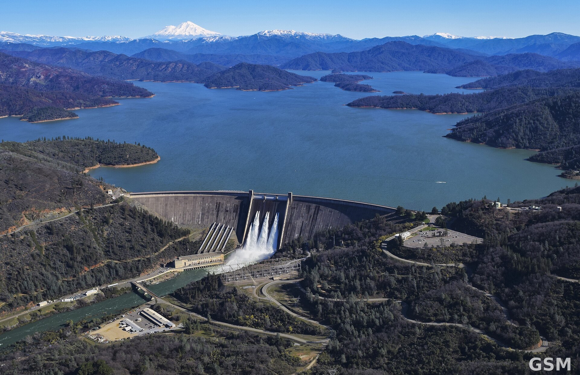
图片来源:图:沙斯塔大坝与沙斯塔湖航拍(资料图,摄于2019年3月)。美国垦务局(USBR)摄,Wikimedia Commons,CC BY-SA 2.0。 / Photo: Aerial view of Shasta Dam and Shasta Lake (file photo, March 2019). Photo by the U.S. Bureau of Reclamation, via Wikimedia Commons, CC BY-SA 2.0.
GSM Global · 本篇英文版 English edition of this story