飓风Lala逼近夏威夷大岛,最大持续风速75英里,暴雨带覆盖大岛
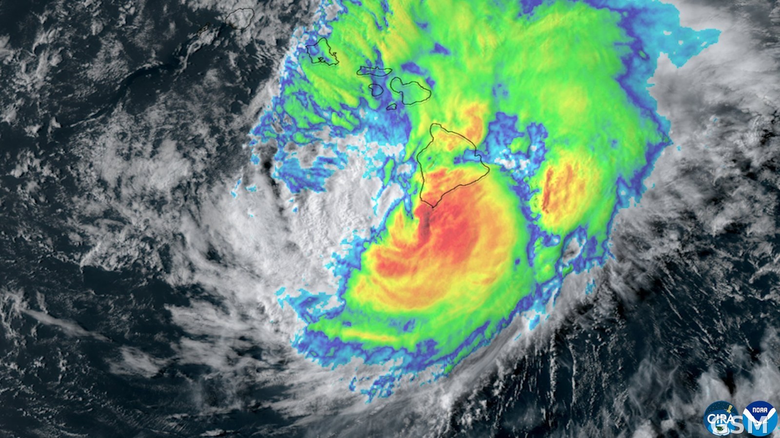
2026年8月15日下午1时(夏威夷时间),美国国家飓风中心与中太平洋飓风中心发布热带气旋更新:飓风Lala位于北纬18.3度、西经155.5度,距夏威夷州大岛最南端South Point以南偏东约50英里,距檀香山东南约260英里。
更新显示,Lala最大持续风速达每小时75英里,正以每小时8英里的速度向西北移动,中心最低气压988毫巴。强降雨带正扩散至大岛全境,带来暴雨与热带风暴级大风。
实测方面,South Point录得持续风速每小时42英里、阵风每小时63英里;火山镇以南的Kealakomo录得阵风每小时48英里。
关联:FEMA 提示夏威夷私营非盈利机构含宗教场所可申请飓风 Lala 公共援助
Hurricane Lala Brings Heavy Rainbands to Hawaii's Big Island With 75 MPH Winds
At 1:00 p.m. Hawaii time on August 15, 2026, the National Hurricane Center and the Central Pacific Hurricane Center issued a tropical cyclone update: Hurricane Lala was located at 18.3 degrees north, 155.5 degrees west, about 50 miles south-southeast of South Point, Hawaii, and about 260 miles southeast of Honolulu.
The update reported maximum sustained winds of 75 mph, movement toward the northwest at 8 mph, and a minimum central pressure of 988 millibars. Heavy rainbands were spreading across the Big Island, producing heavy rain and tropical-storm-force winds.
Observations included sustained winds of 42 mph with a gust to 63 mph at South Point, and a gust to 48 mph at Kealakomo, south of Volcano.
来源:美国国家飓风中心
发布:GSM·美国(发布链接)
图片来源:图:2026年8月17日,飓风Lala掠过夏威夷群岛的卫星云图,大岛在风暴云系覆盖之下。(CIRA/NOAA) / Photo: Satellite image of Hurricane Lala passing the Hawaiian Islands on August 17, 2026, with the Big Island under the storm's cloud shield. (CIRA/NOAA)
GSM Global · 本篇英文版 English edition of this story
- 2026-08-15 18:42飓风Lala逼近夏威夷大岛,最大持续风速75英里,暴雨带覆盖大岛本篇
- 2026-11-10 07:53FEMA 提示夏威夷私营非盈利机构含宗教场所可申请飓风 Lala 公共援助