菲律宾达沃东方省外海发生6.2级地震,深92.8公里、无海啸
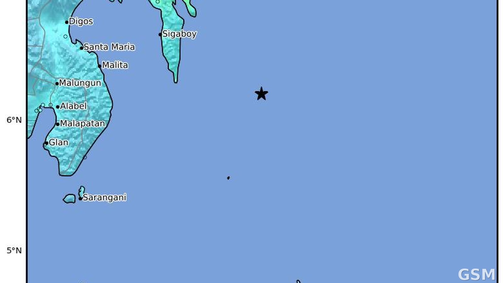
2026年6月15日,菲律宾达沃东方省 Pondaguitan 东南东76公里外海发生6.2级地震。据美国地质调查局(USGS)终版目录,地震发生于协调世界时6月15日9时18分(菲律宾时间17时18分),震源深度92.76公里,属中深源地震。
USGS 对本次地震的评估警报为绿色,表示其评估的人员伤亡与经济损失风险低;本次地震未引发海啸。目录记录显示,有感报告33份,社区确定的烈度为5.4。
正文按 USGS 终版参数成稿:震级6.2级、深度92.76公里这一较深的震源,是烈度未如浅源强震那样集中的主要背景。本稿只写已由 USGS 目录确认的事实,不渲染伤亡。
Magnitude 6.2 Earthquake Strikes Off Davao Oriental, Philippines, at 92.8 km Depth; No Tsunami
A magnitude 6.2 earthquake struck 76 kilometers east-southeast of Pondaguitan in Davao Oriental Province, Philippines, on June 15, 2026. According to the reviewed catalog of the U.S. Geological Survey (USGS), the quake occurred at 09:18 UTC (5:18 p.m. Philippine time) on June 15 at a depth of 92.76 kilometers, an intermediate-depth event.
The USGS alert level for the earthquake is green, indicating a low assessed risk of casualties and economic losses, and the earthquake generated no tsunami. The catalog records 33 felt reports and a community-determined intensity of 5.4.
This story uses the reviewed USGS parameters: the magnitude of 6.2 and the depth of 92.76 kilometers, a comparatively deep focus that is the main reason shaking was less concentrated than in a shallow strong quake. Only facts confirmed in the USGS catalog are reported, with no embellishment of casualties.
来源:美国地质调查局
发布:GSM·美国(发布链接)
图片来源:图:2026年6月15日菲律宾达沃东方省外海6.2级地震的震动强度分布图(本事件图)。美国地质调查局(USGS)作品,公共领域。 / Photo: ShakeMap intensity distribution for the magnitude 6.2 earthquake off Davao Oriental, Philippines, on June 15, 2026 (image of this event). Work of the U.S. Geological Survey (USGS), public domain.
GSM Global · 本篇英文版 English edition of this story