密西西比一条EF3龙卷横扫81.9英里伤23人,全州26人受伤、425户房屋受损
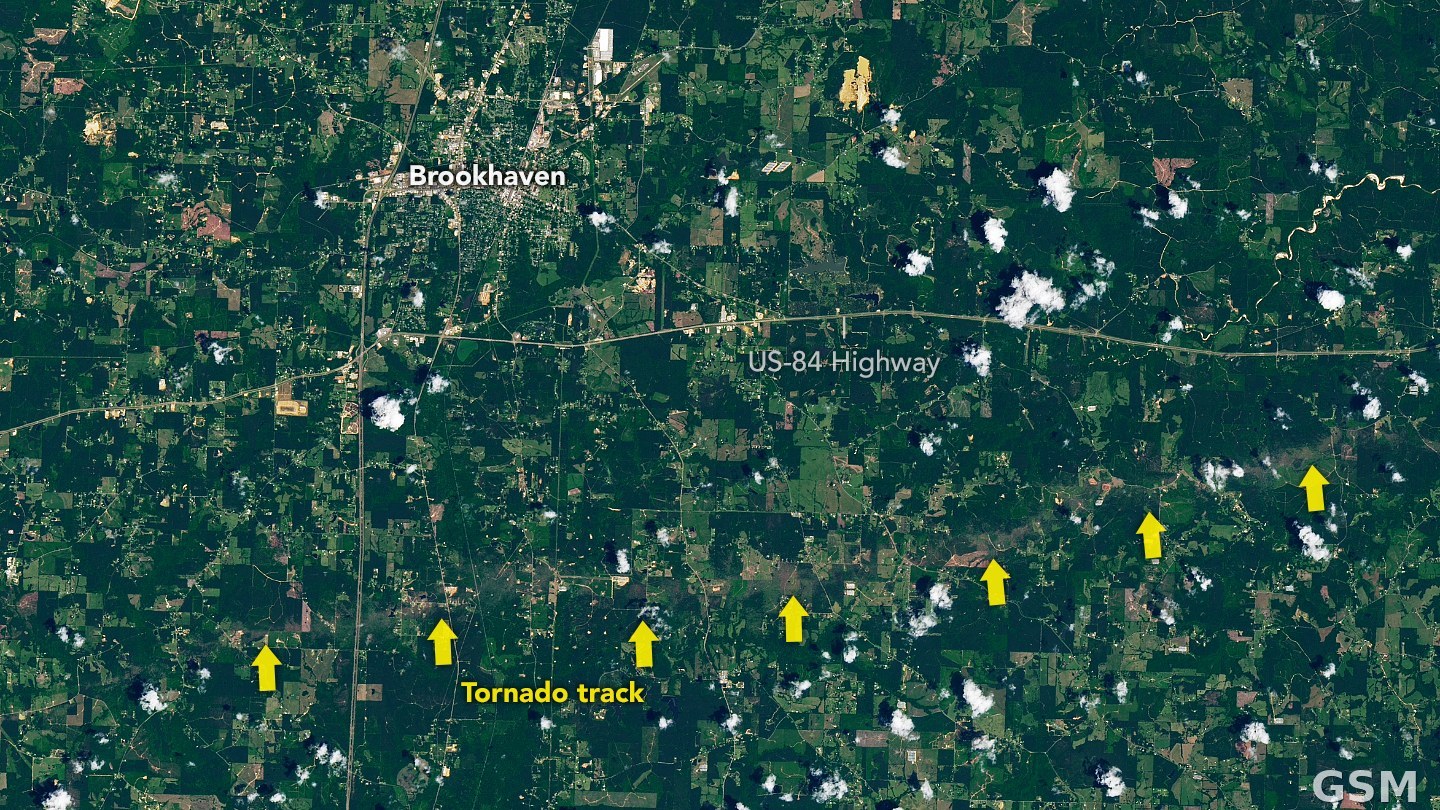
2026年5月6日晚,美国密西西比州南部遭遇一条长路径EF3龙卷:龙卷于当地时间18时22分在 Adams County 的 Dolorosa 以西生成,一路向东横扫至 Lawrence County 的 Monticello 以南才消散,持续2小时9分钟,路径长81.9英里。美国国家气象局 Jackson 办公室的最终修订调查把这条龙卷定为高端EF3,峰值风速上修至每小时160英里,最大宽度1.5英里;仅这条龙卷就造成23人受伤,无人死亡。
当晚,Jackson 气象局辖区共确认6个龙卷,包括这条EF3、一条EF2、两条EF1和两条EF0。密西西比州紧急事务管理局(MEMA)的全州口径与单条龙卷口径不同:全州共有26人受伤,其后联邦重大灾害宣告文件采用的口径为全州425户房屋受损,其中88户全毁、112户重损。
州长于5月19日申请联邦重大灾害宣告,总统其后批准宣告(FEMA-4922-DR-MS),Franklin、Lamar、Lawrence、Lincoln 与 Wilkinson 五县纳入个人援助范围。
关联:堪萨斯州Ottawa遭EF2龙卷风袭击,3人受伤,棒球大冰雹同日落下
Mississippi EF3 Tornado Carves 81.9-Mile Path, Injures 23; Statewide Toll Reaches 26 Hurt and 425 Homes Damaged
On the evening of May 6, 2026, a long-track EF3 tornado tore across southern Mississippi. It touched down at 6:22 p.m. CDT west of Dolorosa in Adams County and stayed on the ground for two hours and nine minutes before lifting south of Monticello in Lawrence County, carving a path 81.9 miles long. The National Weather Service office in Jackson, in its final revised survey, rated it a high-end EF3 with peak winds raised to 160 mph and a maximum width of 1.5 miles. That single tornado injured 23 people and killed no one.
The Jackson office confirmed six tornadoes that night, including the EF3, one EF2, two EF1s and two EF0s. The Mississippi Emergency Management Agency's statewide figures are a separate count from the single-tornado toll: 26 people were injured statewide, and the federal major disaster declaration documents put statewide home damage at 425 homes, of which 88 were destroyed and 112 sustained major damage.
The governor requested a federal major disaster declaration on May 19, and the president later approved it (FEMA-4922-DR-MS), with Franklin, Lamar, Lawrence, Lincoln and Wilkinson counties designated for individual assistance.
Related: EF2 Tornado Hits Ottawa, Kansas, Injuring 3 as Baseball-Size Hail Falls
来源:美国国家气象局
发布:GSM·美国(发布链接)
图片来源:图:2026年5月12日 Landsat 8 卫星拍到的这条EF3龙卷在密西西比州 Lincoln County 留下的植被损害轨迹。NASA Earth Observatory(Lauren Dauphin 制图,USGS Landsat 数据),公共领域。 / Photo: The vegetation damage track left by the EF3 tornado in Lincoln County, Mississippi, imaged by Landsat 8 on May 12, 2026. NASA Earth Observatory image by Lauren Dauphin, using USGS Landsat data, public domain.
GSM Global · 本篇英文版 English edition of this story