跟进:Sentinel-6B完成校准通过全部初始检查,2027年1月接任全球海平面参考卫星
美国航天局(NASA)11月16日发布消息,Sentinel-6B 海平面卫星已完成校准并通过全部初始系统检查,数据质量与精度达到最严格标准;这颗卫星将于2027年1月正式接任全球海平面参考卫星,成为其他海平面观测任务校准数据的基准。NASA 11月9日曾发布该卫星首批精密测高数据,本次是其投入业务运行前的又一关键节点。
Sentinel-6B 于2025年11月16日由 NASA 与欧洲伙伴发射升空。目前担任参考卫星的是它的姊妹星 Sentinel-6 Michael Freilich,该星现阶段在 Sentinel-6B 前方约30秒航程处飞行;交接前后,Michael Freilich 将转入伴飞轨道,双星协同可提供比单星更高分辨率的数据。
每颗 Sentinel-6 卫星都装有雷达高度计,以每秒数千次的频率向海面发射雷达脉冲,通过回波时间测算海洋高度,同时测量海浪大小与海洋风速。由于海水受热膨胀,海平面高度能反映海洋水量与温度的变化。双星提供的高精度海洋测量可用于改进飓风预报、保护沿海基础设施,并服务航运等商业行业。
NASA 表示,两颗卫星已经在提供关键数据,眼下海洋学家预计将出现一次历史性的厄尔尼诺现象,双星数据将帮助科学家研究与厄尔尼诺相关的海平面变化,并监测全球海平面的长期变化。两颗卫星共同组成哥白尼 Sentinel-6/Jason-CS(服务连续性)任务,延续自1990年代初以来不间断、沿同一地面轨迹进行的海洋雷达测高观测序列。
关联:Sentinel-6B海平面卫星首批精密测高数据公开:NASA档案中心发布第31个轨道周期起的产品(来源:美国航天局)
Follow-up: Sentinel-6B Completes Calibration and All Initial Checks, to Become Global Sea-Level Reference Satellite in January 2027
NASA said on November 16 that the Sentinel-6B sea-level satellite has been calibrated and has passed all of its initial system checks, with its data meeting the strictest quality and accuracy standards. In January 2027 the satellite will become the reference satellite for sea-level missions, the benchmark other missions use to calibrate their data. NASA released the satellite's first precision altimetry data products on November 9; this marks the next key step toward full operations.
Sentinel-6B was launched on November 16, 2025, by NASA and its European partners. Its predecessor, Sentinel-6 Michael Freilich, is currently serving as the reference satellite and now flies about 30 seconds ahead of its twin. Around the handover, Michael Freilich will shift into an accompanying orbit, enabling the pair to provide higher-resolution data than either can on its own.
Each Sentinel-6 satellite measures ocean height, wave size and marine wind speed with a radar altimeter that bounces thousands of radar pulses per second off the crests and troughs of waves, timing how long the reflected pulses take to return. Because warm water expands, sea level offers insight into the volume and temperature of ocean water. The pair's high-precision ocean measurements are used to improve hurricane forecasts, help protect infrastructure and benefit commercial industries including shipping.
NASA said the two satellites are already providing crucial data during what oceanographers expect to be a historic El Niño, helping scientists study sea-level changes linked to El Niño and monitor long-term changes in global sea level. Together the satellites make up the Copernicus Sentinel-6/Jason-CS (Continuity of Service) mission, the latest in a series of ocean-observing radar altimetry missions that have monitored Earth's seas continuously along the same ground track since the early 1990s.
Related: Sentinel-6B First Precision Altimetry Data Released (Source: NASA)
来源:美国航天局
发布:GSM·美国(发布链接)
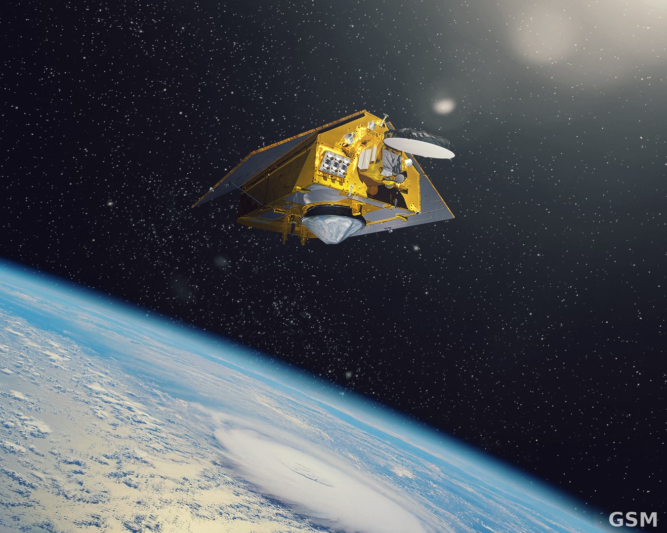
图片来源:图:Sentinel-6B 海平面卫星在轨艺术概念图(PIA26803)。美国航天局(NASA)/喷气推进实验室,公共领域。 / Image: Artist's concept of the Sentinel-6B satellite in orbit (PIA26803). NASA/JPL, public domain.
GSM Global · 本篇英文版 English edition of this story