Sentinel-6B海平面卫星首批精密测高数据公开:NASA档案中心发布第31个轨道周期起的产品
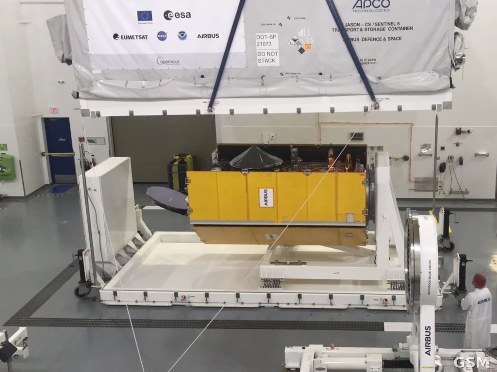
美国国家航空航天局(NASA)的物理海洋学分布式活动档案中心(PO.DAAC)11月5日宣布,Sentinel-6B 海平面监测卫星的首批非时效敏感(NTC)测高数据产品正式公开发布,全球研究者即日起可通过 Earthdata Search 检索、通过 PO.DAAC 数据订阅工具下载。
Sentinel-6B 搭载雷达高度计,任务是高精度测量全球海平面,延续此前 Jason 系列测高卫星积累的长期观测记录。此次发布的数据已经过卫星调试阶段下半段的校准与验证,今年早些时候发布的近实时(NRT)和短时效(STC)产品之外,NTC 是精度处理最完整的一档。
本批产品覆盖第31个轨道周期起的数据,包括 L1A、L1B、L2 三级高度计低速率与高速率数据以及微波辐射计数据。L2 产品同时提供标准版与精简版:标准版含1赫兹与20赫兹数据,精简版只含1赫兹数据;所有 L2 测高数据都包含海面高度异常、有效波高和风速。
海平面长期记录是研判全球海平面变化的基础数据。Sentinel-6B 的精密数据进入公共档案后,这条由 Jason 系列开启的观测序列得以接续,研究者可把新数据与数十年的历史记录放在同一标尺上比较。(来源:美国国家航空航天局)
NASA Releases First Precision Altimetry Datasets From the Sentinel-6B Sea-Level Satellite
NASA's Physical Oceanography Distributed Active Archive Center (PO.DAAC) announced on November 5 the first public release of non-time-critical (NTC) altimetry data products from the Sentinel-6B satellite, available through Earthdata Search and downloadable with subsetting options via the PO.DAAC Data Subscriber Tool.
Sentinel-6B's radar altimeter mission provides high-precision measurements of global sea level, building on the extensive observation record of the earlier Jason series of altimetry missions. The NTC products were validated during calibration and validation activities in the second half of the satellite's commissioning phase, following near-real-time (NRT) and short-time-critical (STC) products released earlier this year.
The release covers L1A, L1B and L2 altimeter low-rate and high-rate data, plus microwave radiometer data, processed in NTC latency from cycle 31 onward. L2 datasets come in standard and reduced forms: standard products contain both 1 Hz and 20 Hz data, while reduced products contain only 1 Hz data. Sea surface height anomaly, significant wave height and wind speed are included in all L2 altimetry datasets.
A continuous, precise sea-level record is the baseline for tracking global sea-level change. With Sentinel-6B's precision data now in the public archive, the observation series begun by the Jason missions continues on the same measurement standard. (Source: National Aeronautics and Space Administration)
来源:美国国家航空航天局
发布:GSM·美国(发布链接)
图片来源:图:Copernicus Sentinel-6 海平面监测卫星揭幕现场。Wikimedia Commons 图片(CC BY-SA 3.0 IGO,欧洲航天局)。 / Photo: The Copernicus Sentinel-6 sea-level monitoring satellite at its unveiling. Image via Wikimedia Commons (CC BY-SA 3.0 IGO, European Space Agency).
GSM Global · 本篇英文版 English edition of this story