NASA卫星图:印尼查亚峰冰川只剩1988年的约2%,已薄到不再流动
美国航天局(NASA)地球观测站11月16日发布卫星图像对比:印度尼西亚新几内亚岛 Sudirman 山脉查亚峰(Puncak Jaya)山顶附近的冰体,到2025年9月只剩约0.09平方公里,约为1988年4.31平方公里的2%,残存冰体已经薄到无法再像冰川那样流动。
这组对比图分别由 Landsat 5 卫星的专题制图仪摄于1988年、Landsat 9 卫星的陆地成像仪摄于2026年10月19日。假彩色图像中,冰呈浅蓝色,裸露的基岩呈棕色。查亚峰海拔4,884米,是赤道附近少数常年有冰的地方之一,当地冰川被科学家称作高海拔的「煤矿金丝雀」。
印度尼西亚气象、气候与地球物理局(BMKG)气候科学家 Donaldi Permana 表示,冰体不仅面积锐减,厚度也在塌缩:主要监测点 East Northwall Firn 的冰厚从2010年的32米降到2023年的4米,到2024年11月,该监测点的冰已经完全消失。
冰体变薄后会碎裂成小块,新露出的边缘又加速融化。Permana 说,高海拔岩缝里还留有少量残冰,但它们作为活跃冰川的功能性生命实际上已经结束。马里兰大学冰川学家 Chris Shuman 把这一过程比作「纸牌屋」:一旦开始,就很难回头。
近期卫星研究估计,查亚峰主要冰区可能在2030年前后完全消失,BMKG 的估计还要更早,并指出当前的厄尔尼诺会加快这一进程:2015至2016年厄尔尼诺期间,当地冰层一年变薄约5.3米,约为平常的五倍。BMKG 计划在12月开展航测,给出2026年残冰量的新估计。
(来源:美国航天局)
NASA Satellite Images: Glaciers on Indonesia's Puncak Jaya Down to About 2% of Their 1988 Extent, Too Thin to Flow
NASA's Earth Observatory released a satellite image comparison on November 16 showing that the ice near the summit of Puncak Jaya, in Indonesia's Sudirman Range on the island of New Guinea, had shrunk to about 0.09 square kilometers by September 2025 — roughly 2 percent of the 4.31 square kilometers recorded in 1988 — and that the remaining ice is now too thin to flow like a glacier.
The image pair was acquired in 1988 by the Thematic Mapper on Landsat 5 and on October 19, 2026, by the Operational Land Imager on Landsat 9. In the false-color images, ice appears light blue and exposed bedrock brown. At 4,884 meters, Puncak Jaya is one of the few places near the equator that have long held ice year-round, and scientists have described its glaciers as high-altitude canaries in the coal mine.
Donaldi Permana, a climate scientist at Indonesia's Agency for Meteorology, Climatology, and Geophysics (BMKG), said the ice has thinned as well as shrunk: at the primary monitoring site on the East Northwall Firn, thickness fell from 32 meters in 2010 to 4 meters in 2023, and by November 2024 the ice at that site was gone.
As the glaciers thin, they break apart, and each new fragment adds exposed edges where ice can melt. Permana said that while small remnants persist in high-altitude crevices, their functional life as active glaciers is effectively over. University of Maryland glaciologist Chris Shuman called the process a house of cards: once it gets going, there is really no turning back.
Recent satellite studies suggest the main glacial ice areas could disappear completely around 2030, and BMKG estimates suggest they could be gone sooner, hastened by the current El Niño: during the 2015-2016 El Niño, the ice thinned about 5.3 meters in a single year, roughly five times faster than usual. An aerial survey planned for December should yield a 2026 estimate of how much ice remains.
(Source: NASA)
来源:美国航天局
发布:GSM·美国(发布链接)
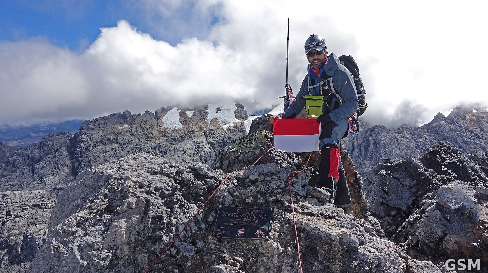
图片来源:图:印度尼西亚查亚峰(又名 Carstensz Pyramid)峰顶,峰后山坡上可见残存冰体(2015年摄,本图经裁切)。照片:Mário Simoes,CC BY 2.0,经 Wikimedia Commons。 / Photo: The summit of Puncak Jaya (Carstensz Pyramid) in Indonesia, with remnant ice visible on the slopes behind (taken in 2015; cropped). Photo by Mário Simoes, CC BY 2.0, via Wikimedia Commons.
GSM Global · 本篇英文版 English edition of this story