NASA拨款1590万美元延长GEDI森林测绘任务至2029年10月:马里兰大学领衔
马里兰大学 11月12日公布,美国国家航空航天局(NASA)已选中由马里兰大学领衔的全球生态系统动态调查(GEDI)任务作第三次延长,拨款 1590 万美元,支持其在国际空间站上的科学运行延续至 2029 年 10 月。这一决定来自 NASA 2026 年资深评审,该评审评估各地球观测任务的科学价值与运行表现。
GEDI 由马里兰大学与 NASA 戈达德太空飞行中心合作运行,首席研究员为马里兰大学地理科学系特聘教授 Ralph Dubayah。该仪器以激光雷达方式测量地球森林的三维结构,是专为获取茂密森林冠层结构设计的星载激光雷达观测。
在 2026 年评审中,GEDI 的整体科学获 Excellent/Very Good 评级,对国家利益的效用获 High 评级,技术风险与成本风险均获 Low 的有利评级。马里兰大学地理科学系称,GEDI 自运行以来已支撑 800 多篇科学出版物。
GEDI 于 2018 年 12 月发射,2019 年 3 月开始采集科学数据,原定任务期为两年。此次延长后,其森林观测记录将接近十年。
接续任务方面,NASA 于 2026 年选定的地球动力学大地测量探索者(EDGE)以 GEDI 建立的科学与技术基础为依托,目前计划于 2030 年发射,采用新的幅宽成像激光雷达方式在全球尺度测量陆地生态系统结构。马里兰大学研究人员在 EDGE 团队中担任多项角色。
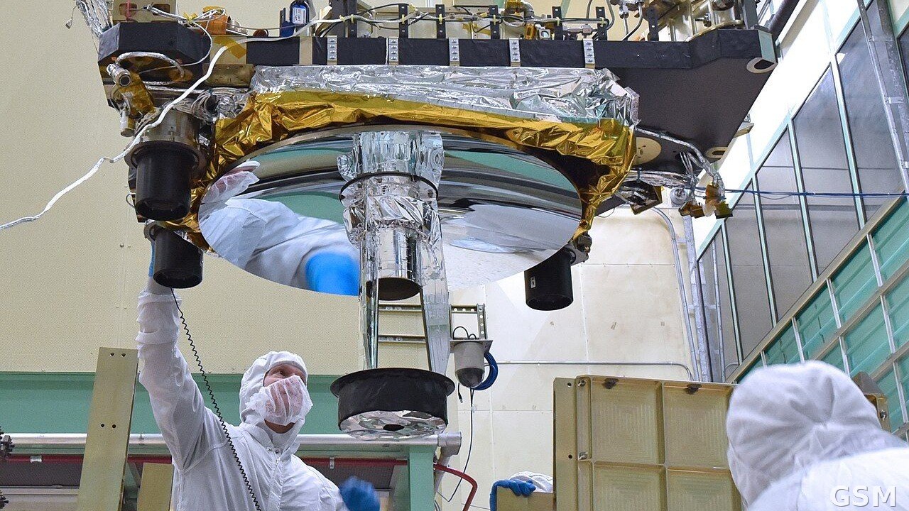
图中是技术人员正在集成GEDI仪器的光学平台与箱体结构
NASA Awards 15.9 Million Dollars to Extend UMD-Led GEDI Forest Mission Through October 2029
The University of Maryland announced on November 12 that NASA has selected the University of Maryland-led Global Ecosystem Dynamics Investigation, or GEDI, for a third mission extension, awarding 15.9 million dollars to continue science operations aboard the International Space Station through October 2029. The decision follows NASA 2026 Senior Review, which evaluated the scientific value and operational performance of the agency Earth-observing missions.
GEDI is led by the University of Maryland in partnership with NASA Goddard Space Flight Center. Its principal investigator is Distinguished University Professor Ralph Dubayah of the Department of Geographical Sciences. The instrument uses lidar to measure the three-dimensional structure of Earth forests, and provides the only spaceborne lidar observations specifically designed to retrieve forest canopy structure in dense forests.
In the 2026 review, GEDI received an Excellent/Very Good rating for overall science, a High rating for its utility to national interests, and favorable Low ratings for both technical and cost risks. The university department said GEDI has contributed to more than 800 scientific publications since it began operations.
GEDI was launched in December 2018 and began collecting science data in March 2019, with an original mission duration of two years. The extension will bring its record of forest observations to nearly a decade.
NASA Earth Dynamics Geodetic Explorer, or EDGE, selected in 2026 and currently planned for launch in 2030, builds on the scientific and technological foundation GEDI established. EDGE will use a swath-imaging lidar approach to provide three-dimensional measurements of terrestrial ecosystem structure on a global scale, with University of Maryland researchers playing leading roles.
来源:马里兰大学
发布:GSM·美国(发布链接)
图片来源:图:技术人员正在集成GEDI仪器。来源:NASA戈达德太空飞行中心/Barbara Lambert,公共领域,维基共享资源。 / Photo: Technicians integrating the GEDI instrument. Credit: NASA Goddard Space Flight Center / Barbara Lambert, public domain, via Wikimedia Commons.
GSM Global · 本篇英文版 English edition of this story