苏必利尔湖周日晚浪高可达18英尺:周一短暂平静后,周三北风再起、浪高重回9英尺
美国国家气象局 Marquette 办公室11月8日晚10时发布的苏必利尔湖开阔水域预报说,湖面东段(Grand Marais 至 Whitefish Point 一带)周日晚北风可达30节、阵风可达40节,浪高10至14英尺,个别浪高可达18英尺,随后回落到3至6英尺;周一白天风浪明显减弱,浪高降到接近平静至2英尺,是这一周里难得的平静窗口。
平静不会持续太久。预报说,周一晚西南风转西风并增强到20至30节,浪高重新升到4至7英尺、个别7至9英尺;周二西北风20至30节,浪高4至8英尺、个别可达10英尺。湖面中段(Manitou Island 至 Marquette 以西水域)周一晚西风可达30节、阵风35节,周二白天维持35节大风。
周三夜里是下一个高点:北风20至30节、午夜后增强到35节大风,降雨可能夹雪,浪高4至7英尺、个别可达9英尺;周四北风大风逐渐减弱,并有阵雪机会,浪高3至6英尺、个别8英尺。湖面西段本周相对平静,周一浪高只有1至3英尺。
气象局的形势概要说,一个30.0英寸的气压脊周一上午仍盘踞湖面,随后一个29.6英寸的低压经 Lake Winnipeg 向东移动、减弱为29.7英寸,周一晚给湖面带来29.8英寸的低压槽;周二至周三,30.4英寸的高压在 Manitoba 与 Ontario 上空建立,并缓慢向东南移动,周五抵达苏必利尔湖西段时为30.2英寸。
这份预报针对离岸5海里以外的开阔水域,浪高指有效波高,个别浪高为浪谱中最高十分之一波浪的平均值。在湖上作业与航行的船只,应按逐日预报安排窗口:周一白天最平稳,周日晚与周三晚最危险。(来源:美国国家气象局)
Lake Superior Waves May Reach 18 Feet Sunday Night, Calm Monday, Then Build Again Wednesday
The National Weather Service office in Marquette, Michigan, said in its open-lake forecast for Lake Superior issued at 10:00 p.m. EST on Sunday, November 8, 2026, that the eastern waters from Grand Marais to Whitefish Point would see north winds to 30 knots with gusts to 40 knots possible on Sunday night, with waves of 10 to 14 feet and occasional waves to 18 feet, subsiding to 3 to 6 feet. By Monday the lake calms markedly, with waves subsiding to calm to 2 feet in the day's most settled window of the week.
The calm will not last. On Monday night, southwest winds turn west and build to 20 to 30 knots, with waves rebuilding to 4 to 7 feet and occasionally 9 feet, and on Tuesday northwest winds of 20 to 30 knots raise waves of 4 to 8 feet, occasionally 10 feet. In the central waters west of Manitou Island to Marquette, west winds may reach 30 knots with gale-force gusts to 35 knots by midnight Monday night, and west gales to 35 knots continue into Tuesday before diminishing.
Wednesday night brings the next peak: north winds of 20 to 30 knots increasing to gales of 35 knots after midnight, rain showers possibly mixed with snow, and waves building to 4 to 7 feet, occasionally 9 feet. On Thursday the north gales diminish, with a chance of snow showers and waves of 3 to 6 feet, occasionally 8 feet. The western lake stays comparatively quiet, with Monday waves of only 1 to 3 feet.
In its synopsis, the Weather Service said a 30.0-inch ridge lingers over the lake into Monday morning, while a 29.6-inch low moving over Lake Winnipeg weakens to 29.7 inches and brings 29.8-inch troughing over Lake Superior on Monday night. From Tuesday into Wednesday, 30.4-inch high pressure builds over Manitoba and Ontario and descends slowly southeast, reaching western Lake Superior at 30.2 inches on Friday.
The forecast covers open waters beyond five nautical miles from shore; wave figures are significant wave heights, and occasional heights are the average of the highest one-tenth of the wave spectrum. Mariners should plan around the windows the forecast lays out: Monday daytime is the calmest period, while Sunday night and Wednesday night are the most dangerous. (Source: National Weather Service)
来源:美国国家气象局
发布:GSM·美国(发布链接)
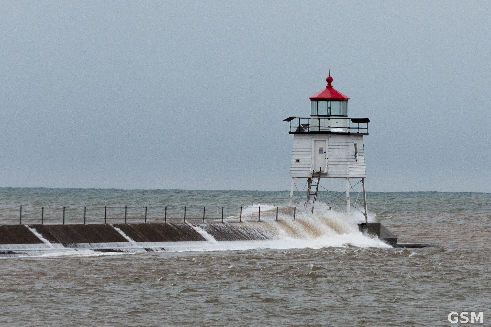
图片来源:图:大浪冲上苏必利尔湖北岸 Two Harbors 的防波堤。Wikimedia Commons 图片(CC BY-SA 2.0)。 / Photo: Waves crash over the Two Harbors breakwater on Lake Superior's North Shore. Image via Wikimedia Commons (CC BY-SA 2.0).
GSM Global · 本篇英文版 English edition of this story