南安普顿大学 Old Sarum 雷达测绘公布:城墙厚达3.5米,教堂区发现早于中世纪大教堂的建筑遗存
英国南安普顿大学考古系师生对位于 Salisbury 以北的 Old Sarum 遗址进行了探地雷达测绘,绘制出这座中世纪城市的地下布局。大学人文学院11月6日公布了这一成果,相关报道于11月12日发布。
测绘记录到的遗存包括城墙厚达3.5米的防御性建筑、教堂、房屋、道路,以及包括粪坑在内的基础设施。测绘覆盖的重点是这座在12至13世纪有人居住的城市,目标是以高分辨率绘制其布局。
调查由 Dominic Barker 与 Kristian Strutt 主持。两人表示,成果超出预期,并显示遗址上存在更早阶段的人类活动,包括可能的罗马时期遗存。在大教堂辖区内,雷达还记录到一组早于中世纪大教堂的建筑,其年代尚未确定,早期中世纪或罗马时期的来源目前只是一种可能,而非定论。
技术方面,调查使用由全地形车拖曳的八通道探地雷达系统,配合 GPS 定位;天线频率为450MHz,探测深度超过3米,读数分辨率为0.1米乘0.03米。2025年与2026年两个夏季的干燥天气被认为帮助雷达呈现了城市的精细细节。两个季度的野外工作同属该遗址一个更长期的研究项目。
研究者同时说明,雷达只能记录地下遗存的形状、深度与位置,本身不能断代;要确定这些早期建筑的建造时间,仍需发掘或地层测年证据。
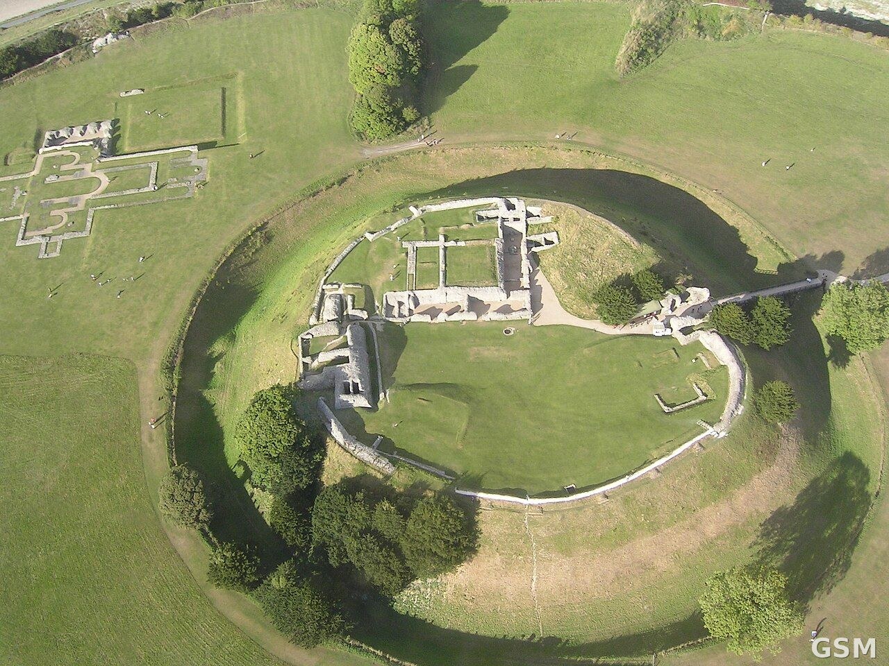
图中是 Old Sarum 遗址的航拍全景,本次雷达测绘在此进行。
University of Southampton Publishes Old Sarum Radar Survey: Walls 3.5 Metres Thick, Structures Pre-Dating the Medieval Cathedral Found in Cathedral Precinct
Staff and students from the University of Southampton's Department of Archaeology have mapped the buried layout of the medieval city at Old Sarum, north of Salisbury, using ground-penetrating radar. The university's Faculty of Arts and Humanities published the results on November 6, with reporting following on November 12.
The survey recorded defensive buildings with walls 3.5 metres thick, churches, houses and roads, together with infrastructure including cesspits. It was designed to map, at high resolution, a city occupied in the 12th and 13th centuries.
The survey was directed by Dominic Barker and Kristian Strutt, who said the results exceeded expectations and showed earlier phases of activity on the site, including possible Roman remains. In the cathedral precinct, the radar also recorded a series of structures that pre-date the medieval cathedral; no date has been attached to them, and early medieval or Roman origins are presented as a possibility rather than a finding.
The survey used an eight-channel ground-penetrating radar system towed by an all-terrain vehicle and positioned with GPS. The antennae ran at 450MHz, measured to a depth of over 3 metres, and recorded readings at a resolution of 0.1 metres by 0.03 metres. The dry summers of 2025 and 2026 were credited with helping the survey show the city in fine detail. The two radar seasons form part of a broader project at the site.
The researchers note that radar records the shape, depth and position of buried features but does not date them; establishing when the earlier structures were built would require excavation or dating evidence from the deposits themselves.
发布:GSM·美国(发布链接)
图片来源:MARKEDWARDS, CC BY-SA 4.0, via Wikimedia Commons
GSM Global · 本篇英文版 English edition of this story