气候预测中心发大气河流展望:11月12日至15日西海岸强降水、高山雪与沿海大风列中风险
美国国家海洋和大气管理局(NOAA)气候预测中心于美东时间11月4日下午3时发布概率灾害展望,有效期为11月12日至18日。展望指出,一个高度增幅的中层低压槽下周将逼近美国西海岸,带来与大气河流活动相符的向岸气流,西海岸出现强降水、大风与高海拔强雪的概率升高,太平洋西北部与加州北部可能发生洪水。
分项风险中,11月12日至15日,太平洋西北部与加州北部、中部的强降水被列为「中风险」;Klamath 山脉与 Sierra Nevada 山脉的高海拔强雪为「中风险」;华盛顿州、俄勒冈州沿海及加州大部分沿海地区的大风为「中风险」。11月12日至18日全段,西海岸强降水、高海拔强雪与大风另列「低风险」,范围延伸至西南沙漠、大盆地与落基山脉南部等地;东北部部分地区11月12日另有大风低风险。
气候预测中心表示,模式已能较清楚地识别至少两轮水汽侵入:一轮始于第一周末段,另一轮在第二周初段;但各模式对侵入的时间、强度与范围仍有分歧。集合预报工具显示,中加州以北至华盛顿州西部一带,降水量超过气候第85百分位的概率约为30%至50%,超过1至2英寸降水的概率最高。中心同时指出,原始工具逐日波动较大、高度场演变仍有不确定性,因此本轮未发布任何「高风险」等级。
展望还提到,第二周强低压槽预计全程维持,大气河流活动可能持续至11月中旬,时长偏长;低海拔地区的过量降水可能引发流域响应,过火烧迹地还可能出现局地洪水。展望由预报员 Nick Novella 签发,中心提醒公众查阅当地国家气象局办公室的短期预报与地区信息。(来源:美国国家海洋和大气管理局)
Climate Prediction Center Issues Atmospheric River Outlook: Moderate Risk of Heavy Rain, Mountain Snow and Coastal Winds on West Coast Nov. 12-15
The Climate Prediction Center of the National Oceanic and Atmospheric Administration (NOAA) issued its Probabilistic Hazards Outlook at 3 p.m. Eastern on November 4, valid November 12 to 18. The outlook says a highly amplified mid-level low pressure system will encroach on the West Coast during week two, promoting onshore flow consistent with atmospheric river activity, with elevated chances of heavy precipitation, high winds and high-elevation heavy snowfall, and possible flooding over the Pacific Northwest and northern California.
For November 12 to 15, the outlook posts a moderate risk of heavy precipitation for parts of the Pacific Northwest and northern and central California; a moderate risk of heavy high-elevation snow across the Klamath and Sierra Nevada mountains; and a moderate risk of high winds across coastal portions of Washington, Oregon and much of California. A slight risk of heavy precipitation, heavy high-elevation snow and high winds extends across the West Coast into parts of the Desert Southwest, Great Basin and Southern Rockies through November 18, and a slight risk of high winds also covers parts of the Northern and Central Appalachians, the Lower Great Lakes, the Upper Mid-Atlantic and the Northeast on November 12.
The center said models now better identify at least two periods of enhanced moisture intrusion, one beginning late in week one and another during the early portion of week two, though models still vary on timing, strength and spatial extent. Ensemble tools indicate 30 to 50 percent chances of precipitation amounts exceeding the 85th climatological percentile, with the highest probabilities of amounts exceeding one and two inches focused from central California northward to western Washington. Because of day-to-day volatility in the raw tools and uncertainty in the evolving height pattern, no high-risk designations were posted.
The favored persistence of strong troughing for the entirety of week two supports the potential for atmospheric river activity of longer duration through mid-November, the outlook said, and excess precipitation over burn-scarred areas may trigger localized flooding. The outlook, issued by forecaster Nick Novella, advises the public to consult local National Weather Service forecast offices for short-range forecasts and region-specific information. (Source: National Oceanic and Atmospheric Administration)
来源:美国国家海洋和大气管理局
发布:GSM·美国(发布链接)
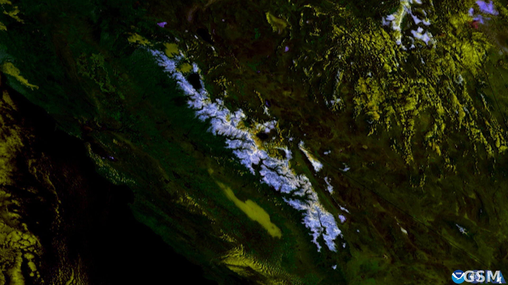
图片来源:图:卫星视角下的 Sierra Nevada 山脉积雪(2025年10月16日),该山脉被气候预测中心列入高海拔强雪中风险区。CSU/CIRA 与 NOAA 影像,公共领域,经 Wikimedia Commons。 / Photo: Satellite view of snow over the Sierra Nevada (October 16, 2025), a range the Climate Prediction Center placed under a moderate risk of heavy high-elevation snow. CSU/CIRA and NOAA imagery, public domain, via Wikimedia Commons.
GSM Global · 本篇英文版 English edition of this story