地质调查局启动德州中部低空地质飞行:覆盖 Llano Uplift 十一县测绘关键矿产
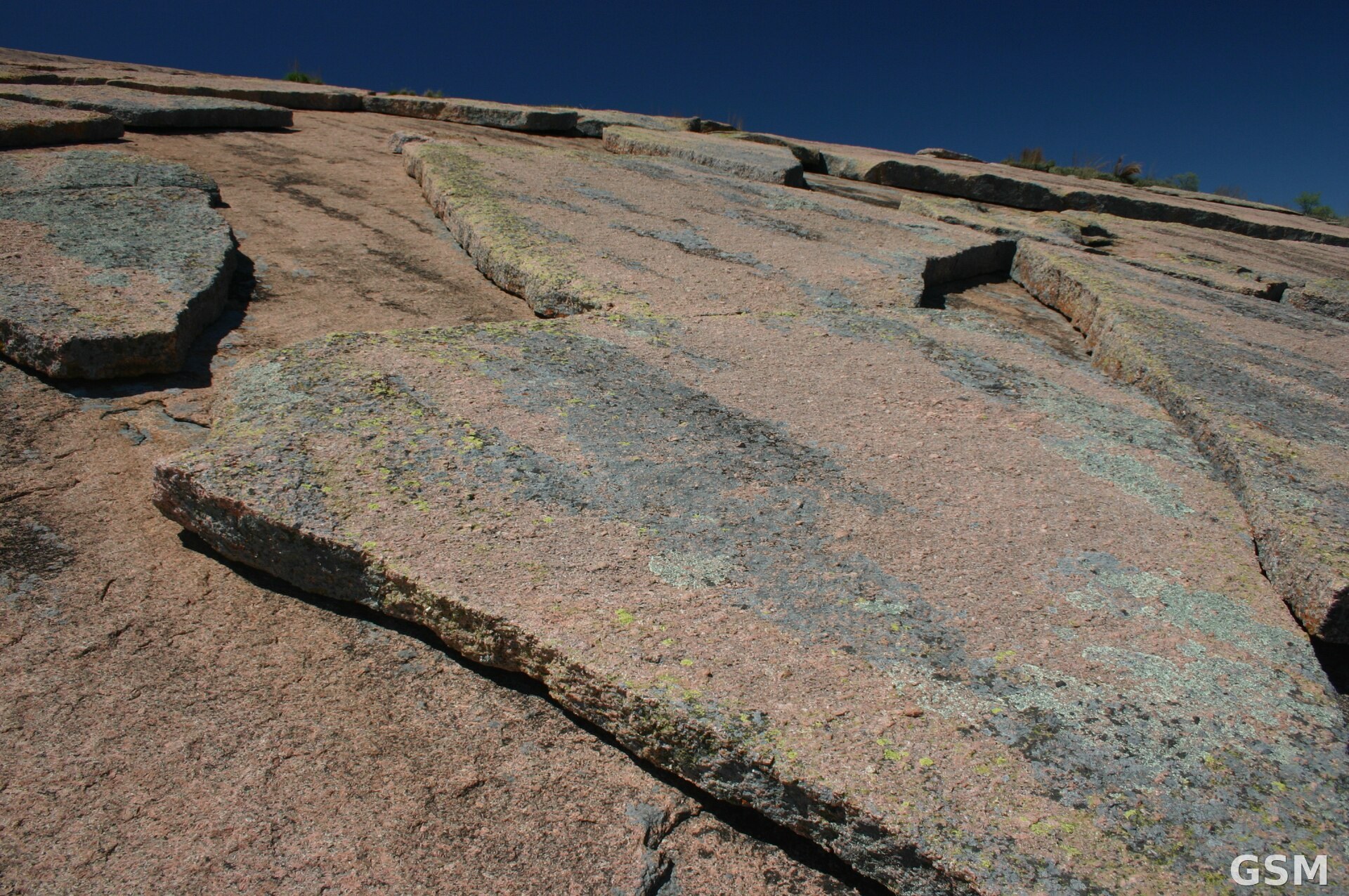
位于德克萨斯州中部的 Llano 地区上空,11月初将出现一批贴地飞行的测量飞机。美国地质调查局(USGS)11月3日发布媒体通告:低空飞行将于11月初在德州中部展开,用航空地球物理技术为 Llano Uplift(拉诺隆起)地区成像测绘,通告由该局位于 Virginia 州 Reston 的总部发出。
这项调查是地质调查局「地球测绘资源计划」(Earth MRI)与德克萨斯州经济地质局(Texas Bureau of Economic Geology)的合作项目。Earth MRI 旨在更新全美的地质与矿产资源地图,并识别能源、地下水资源与自然灾害相关信息。地质调查局 Earth MRI 科学协调员 Jamey Jones 表示,与州级调查机构的合作有助于实现国家目标,例如测绘美国所需的关键矿产;德州经济地质局同时也能借此增加对本州水资源、地质灾害与资源经济至关重要的知识。
Llano Uplift 是本轮测绘的重点区域。德克萨斯州地质师、州经济地质局局长 Lorena Moscardelli 表示,Earth MRI 的数据集来自联邦与州协调合作,目标是以全州尺度获取现代地球科学数据、向公众公开,并显著增进对德州地质的理解;2026年的这次航空地球物理调查是该州同类工作中规模最大的之一,瞄准的 Llano Uplift 正因有望支撑国内关键矿产供应而受到越来越多的关注。
调查区内设有一个石墨重点区,石墨是先进电池所需的材料。区内的历史采矿记录还显示存在稀土元素以及钽、铌、钨等其他关键矿产。测绘成果还将服务州经济地质局的其他战略重点,包括一个银铅锌重点区,以及受区域断层控制的地下水资源研究。
飞行作业的技术参数已经公布:飞机沿预先规划的航线采集磁力与放射性数据,航线间距660英尺(约200米),名义离地高度约330英尺(约100米)。地质调查局已承包 NV5 公司采集航空磁力与放射性数据,其固定翼飞机尾部装有伸长的「尾刺」,内含采集数据的传感器。通告强调,这些科学仪器完全被动、无任何对人、动物或植物构成风险的排放,飞行中不采集任何摄影或视频数据;飞行员均经验丰富、受过低空飞行专门训练并获批准,与联邦航空管理局(FAA)协作确保飞行安全合法,调查只在白天进行。
航班将以 Llano Municipal Airport 为基地,飞越以下十一县:Blanco、Burnet、Gillespie、Kerr、Kimble、Lampasas、Llano、McCulloch、Mason、Menard 与 San Saba。
Earth MRI 计划除航空地球物理调查外,还包括地球化学侦察调查、激光雷达(LiDAR)地形测绘、高光谱调查与地质填图项目。所采集的数据将通过地质调查局 ScienceBase 网站免费向公众开放。
(来源:美国地质调查局)
USGS Begins Low-Level Geology Flights Over Central Texas, Mapping the Llano Uplift for Critical Minerals
RESTON, Va. — Low-level airplane flights will begin in early November over central Texas to image geology using airborne geophysical technology, the U.S. Geological Survey (USGS) announced in a media alert on November 3.
The flights are a collaborative effort between the USGS Earth Mapping Resources Initiative (Earth MRI) and the Texas Bureau of Economic Geology. Earth MRI is an effort to modernize the nation's maps of geology and mineral resources, and to identify energy and groundwater resources and natural hazards.
"Partnership with state surveys helps accomplish national goals like mapping the critical minerals the U.S. needs. The Texas Bureau of Economic Geology is helping with the work of the nation — and adding to state knowledge crucial to water resources, hazards and the resource economy," said Jamey Jones, science coordinator for the USGS Earth Mapping Resources Initiative.
"Earth MRI datasets are the result of a coordinated federal-state partnership designed to acquire modern geoscientific data at a statewide scale, make those data publicly available, and significantly advance our understanding of the geology of Texas. The 2026 airborne geophysical survey is one of the largest efforts of its kind in the state, targeting the Llano Uplift in Central Texas, a region of growing interest for its potential to support domestic supplies of critical minerals and rare earth elements," said Texas State Geologist Lorena Moscardelli, director of the Texas Bureau of Economic Geology.
The Llano Uplift survey includes a focus area for graphite, which is needed for advanced batteries. Historical mining records within the survey area indicate other critical minerals such as rare earth elements, tantalum, niobium and tungsten are present. The survey will also inform strategic priorities of the Texas Bureau of Economic Geology, including a silver-lead-zinc focus area and groundwater resources controlled by regional faults.
The survey includes magnetic and radiometric data collection from aircraft along pre-planned flight lines spaced 660 feet (200 meters) apart at a nominal terrain clearance of 330 feet (100 meters). The USGS has contracted NV5 to collect the data. Its fixed-wing aircraft is equipped with an elongated stinger extending from the tail that houses the sensors. The instruments are completely passive, with no emissions that pose a risk to humans, animals or plant life, and no photography or video data will be collected. The pilots are specially trained and approved for low-level flying, work with the FAA, and the surveys will be conducted during daylight hours only.
Flights will be based out of Llano Municipal Airport and will fly over eleven Texas counties: Blanco, Burnet, Gillespie, Kerr, Kimble, Lampasas, Llano, McCulloch, Mason, Menard and San Saba.
Earth MRI also includes geochemical reconnaissance surveys, topographic mapping using LiDAR technology, hyperspectral surveys and geologic mapping projects. The data collected are made freely available to the public on the USGS ScienceBase website.
(Source: U.S. Geological Survey)
来源:美国地质调查局
发布:GSM·美国(发布链接)
图片来源:图:德克萨斯州 Enchanted Rock 的粉红花岗岩穹丘剥落面,该岩体位于本次调查的 Llano Uplift 区域内。Wing-Chi Poon 摄,CC BY-SA 2.5,经 Wikimedia Commons。 / Photo: Geological exfoliation of the pink granite dome at Enchanted Rock, Texas, within the Llano Uplift survey area. By Wing-Chi Poon, CC BY-SA 2.5, via Wikimedia Commons.
GSM Global · 本篇英文版 English edition of this story