瓦努阿图发生6.2级地震:震中位于Port-Olry东南偏东43公里,震源深142.8公里
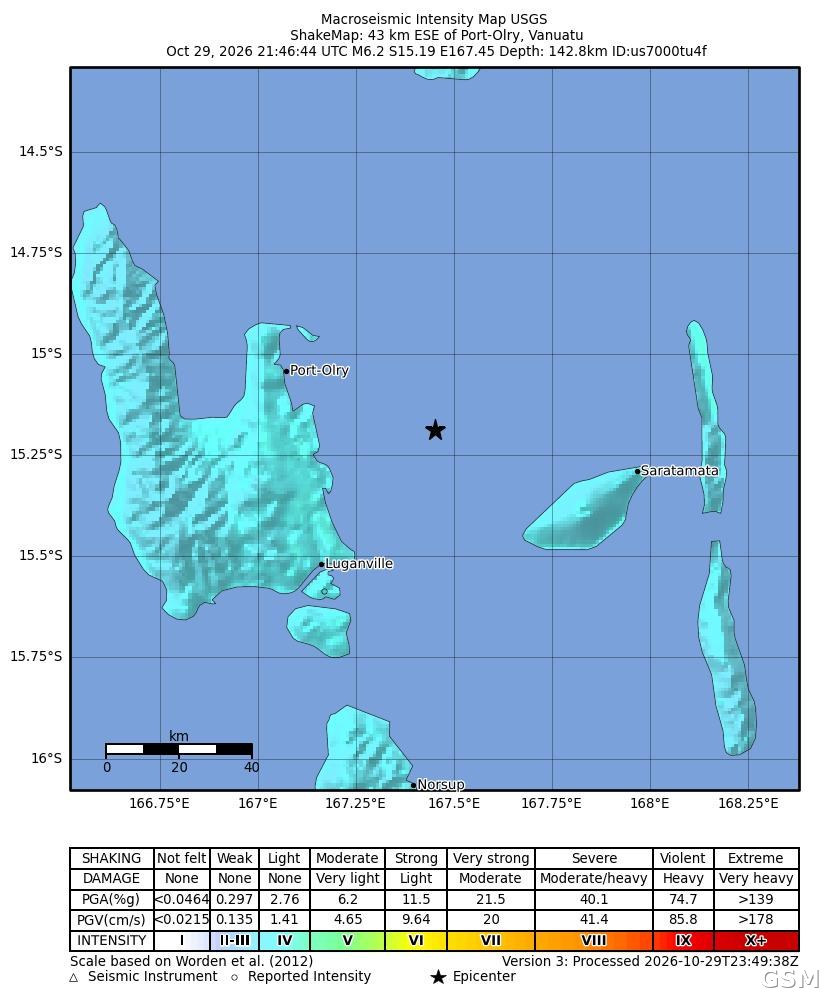
美国地质调查局(USGS)测定,南太平洋岛国瓦努阿图于10月29日21时46分(UTC,瓦努阿图当地时间10月30日8时46分)发生6.2级地震,震中位于该国最大岛屿 Espiritu Santo 岛 Port-Olry 东南偏东43公里处,震源深度142.8公里。
本次地震的震级类型为矩震级6.2级,震中坐标为南纬15.19度、东经167.45度,美国地质调查局的事件编号为 us7000tu4f,测定状态为已复核。震中距该岛主要城镇 Luganville 不远,岛上另有 Saratamata 等聚落位于震中以东的岛屿上。
美国地质调查局将本次地震的警报等级列为绿色,意为出现人员伤亡与经济损失的可能性较低;该局共收到4份有感报告,其发布的震动强度图(ShakeMap)显示,震中周边陆地的震动以轻微等级为主,这与本次地震震源深度超过140公里有关。该局未就此次地震发布海啸警报。
瓦努阿图位于环太平洋地震带上,处在澳大利亚板块与太平洋板块交界附近,地震与火山活动频繁。本次地震的后续测定与当地灾情信息,美国地质调查局将在其事件页面持续更新。
Magnitude 6.2 Earthquake Strikes Vanuatu: Epicenter 43 km ESE of Port-Olry, Depth 142.8 km
A magnitude 6.2 earthquake struck the South Pacific island nation of Vanuatu at 21:46 UTC on October 29 (08:46 local time on October 30), according to the U.S. Geological Survey (USGS). The epicenter was located 43 kilometers east-southeast of Port-Olry, on the country's largest island, Espiritu Santo, at a depth of 142.8 kilometers.
The USGS put the magnitude at 6.2 (moment magnitude), with the epicenter at 15.19 degrees south latitude and 167.45 degrees east longitude. The event, catalogued as us7000tu4f, has been reviewed by seismologists. The town of Luganville, the island's main settlement, lies southwest of the epicenter.
The USGS assigned the earthquake a green alert level, indicating a low likelihood of casualties and economic losses. The agency received four felt reports, and its ShakeMap shows shaking on land near the epicenter was mostly light, consistent with the quake's depth of more than 140 kilometers. The USGS issued no tsunami alert for this event.
Vanuatu sits on the Pacific Ring of Fire near the boundary of the Australian and Pacific plates, and earthquakes and volcanic activity are frequent. The USGS continues to update its event page with any revised measurements.
来源:GSM·美国(原文链接)
图片来源:图:美国地质调查局(USGS)发布的本次地震震动强度图(ShakeMap),星号为震中,位于Port-Olry东南偏东海域。图片:USGS,公共领域。 / ShakeMap for this earthquake published by the U.S. Geological Survey (USGS); the star marks the epicenter, ESE of Port-Olry. Image: USGS, public domain.