NASA 研究:人类活动已在地球水循环留下「指纹」
美国国家航空航天局 NASA 10月20日发布的一项研究显示,人类活动已经在地球水循环中留下了可测量的「指纹」。研究团队利用 GRACE 与 GRACE-FO 两代重力测量卫星 20 多年的数据,绘制出陆地水储量变化图,其空间细节比以往提高 5 到 10 倍,使灌溉、水库蓄水与土地利用变化等人类活动的信号第一次能从自然波动中清晰分离出来。
研究共识别出 40 个水储量变化与人类活动存在显著关联的区域,分布在除澳大利亚之外所有非极地大陆上。在其中 4 个大陆尺度的区域里,人类因素与储量变化趋势的关联强度超过任何单一气候变量。论文第一作者、NASA 戈达德太空飞行中心水文学家 Mary Michael O'Neill 表示,这是第一次能够在全球尺度上定量分离出人类活动对陆地水储量的影响。
储量下降最典型的地区包括加州中央谷地、美国南部高平原、墨西哥 Chihuahua 州与印度北部,地下水持续抽取是共同原因;其中印度北部的储量下降速度超过此前估计,而喜马拉雅冰川退缩只占当地下降的约 15%。上升的例子则有撒哈拉以南非洲雨养农地的扩张与巴西 Maranhão 州大豆种植区。在俄罗斯 Angara 河上,本世纪第二大蓄水工程 Boguchany 水库使当地成为非极地北亚储量上升最强的区域。
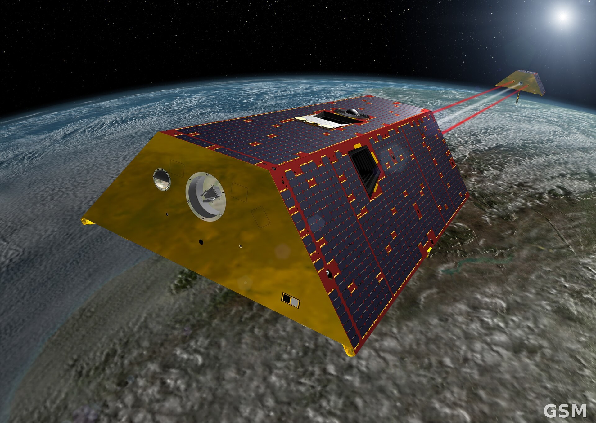
这项研究发表于《美国国家科学院院刊》(PNAS)。研究团队表示,这套方法可以持续监测全球各地的地下水与地表水变化,为水资源管理与干旱应对提供依据。研究所用的 GRACE 系列卫星通过精确测量两颗卫星之间距离的微小变化,反推地球重力场与水体质量的增减。
NASA Study: Human Activity Has Left a Fingerprint on Earth's Water Cycle
Human activity has left a measurable fingerprint on Earth's water cycle, according to a NASA study released on October 20. Using more than two decades of gravity measurements from the GRACE and GRACE-FO satellite missions, researchers produced maps of terrestrial water storage with five to ten times finer spatial detail than before, allowing signals from irrigation, reservoir filling, and land-use change to be separated clearly from natural variability for the first time.
The team identified 40 regions where changes in water storage are significantly tied to human activity, spread across every non-polar continent except Australia. In four continental-scale regions, human activity correlated with storage trends more strongly than any climate variable. Mary Michael O'Neill, a hydrologist at NASA's Goddard Space Flight Center and the study's first author, said it is the first time the human contribution to land water storage has been quantified at a global scale.
The clearest declines appear in California's Central Valley, the southern High Plains of the United States, the Mexican state of Chihuahua, and northern India, all driven by groundwater pumping; northern India's storage is falling faster than previously estimated, while Himalayan glacier retreat accounts for only about 15 percent of the loss there. Gains show up in expanding rain-fed farmland in sub-Saharan Africa and soybean country in Brazil's Maranhão state. On Russia's Angara River, the Boguchany Reservoir, the second-largest reservoir filling of the 21st century, produced the strongest storage increase in non-polar northern Asia.
The study was published in the Proceedings of the National Academy of Sciences. The researchers said the method can keep tracking groundwater and surface water changes worldwide to support water management and drought planning. The GRACE missions infer changes in Earth's gravity field, and thus in water mass, from minute changes in the distance between their twin satellites.
来源:GSM·美国(原文链接)
图片来源:GRACE-FO 双星在轨艺术概念图。图:NASA/JPL-Caltech(公共领域)。 / Artist's concept of the twin GRACE-FO spacecraft in orbit. Image: NASA/JPL-Caltech (public domain).
GSM Global · 本篇英文版 English edition of this story