随机森林预测伊朗东南部荒漠化热点 2040 年荒漠化土地预计扩张约 88,678 公顷
11 月 14 日发表于《科学报告》的一项研究用机器学习方法预测伊朗东南部的荒漠化热点。研究作者为 Farahi 与 Boali,采用 IMDPA 框架,结合遥感数据与 Google Earth Engine,比较了 6 种机器学习算法,并以 AUC、Kappa、TSS、F1 与 Deviance 等指标评估表现。
随机森林表现最佳,AUC 为 0.94、Kappa 为 0.72、TSS 为 0.82、F1 为 0.86。识别出的热点城市包括 Zahedan、Khash、Fanuj、Nikshahr、Chabahar 与 Saravan。
研究以 Markov 链在 SSP2-4.5 与 SSP5-8.5 两种情景下模拟 2040 年土地利用,结果显示,到 2040 年,荒漠化土地预计扩张约 88,678 公顷。
Random Forest Maps Desertification Hotspots in Southeastern Iran, With About 88,678 Hectares of Expansion Projected by 2040
A study published November 14 in Scientific Reports used machine learning to predict desertification hotspots in southeastern Iran. The authors, Farahi and Boali, worked within the IMDPA framework, combining remote sensing data with Google Earth Engine, and compared six machine learning algorithms using AUC, Kappa, TSS, F1, and Deviance.
Random forest performed best, with an AUC of 0.94, Kappa of 0.72, TSS of 0.82, and F1 of 0.86. Hotspot cities identified include Zahedan, Khash, Fanuj, Nikshahr, Chabahar, and Saravan.
Land use for 2040 was simulated with a Markov chain under the SSP2-4.5 and SSP5-8.5 scenarios. The results project that desertified land will expand by about 88,678 hectares by 2040.
来源:《科学报告》
发布:GSM·美国(发布链接)
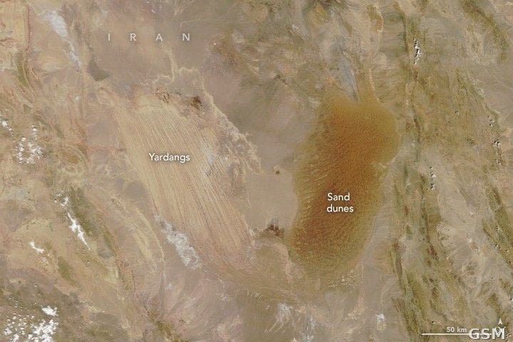
图片来源:图:NASA Terra 卫星 2024 年 4 月拍摄的伊朗 Lut 荒漠,可见风蚀雅丹地貌与沙丘。来源:NASA Earth Observatory (Wanmei Liang),Wikimedia Commons,Public domain。 / Photo: The Lut Desert in Iran photographed by NASA Terra satellite in April 2024, showing wind-eroded yardangs and sand dunes. Source: NASA Earth Observatory (Wanmei Liang), Wikimedia Commons, Public domain.
GSM Global · 本篇英文版 English edition of this story