全球红树林止跌回升:卫星记录显示2010年后增加近2000平方公里
美国航空航天局(NASA)地球观测站11月13日以「每日一图」发布卫星影像与研究介绍:Tulane 大学环境科学家 Zhen Zhang 等人的研究分析了 Landsat 卫星1984年至2023年的影像,发现全球红树林在减少数十年后已经止跌回升,2010年以来增加近2,000平方公里。这项研究今年早些时候发表在《科学》杂志(Science, 392(6802): 1082-1087)。
研究团队逐年追踪全球红树林的面积与林冠密度,统计显示,1984年至2010年间,全球红树林减少近3,000平方公里;2010年之后,增势出乎意料地出现,新增面积近2,000平方公里。许多现存红树林的林冠也比2010年时更密、更完整,南美洲尤其明显,显示森林健康状况改善。
Zhen Zhang 表示,其他团队此前只绘制过部分区域的长期变化,这是第一批覆盖如此长时间跨度的全球红树林地图。他介绍,新增面积中约三分之二来自红树林在新区域定殖,其余三分之一来自退化区域的修复与再生长。
转折最明显的是东南亚,尤其是缅甸。缅甸在1980年代和1990年代因农业、水产养殖扩张与沿海柴薪采伐快速失去红树林,1980年代至2010年间面积减少28.6%;2010年前后趋势逆转,此后面积增长约10%。研究者把逆转归因于2004年印度洋海啸之后保护意识与修复行动的加强、森林法律保护的强化,以及沉积作用形成的新滩涂。NASA 发布的对比影像显示,缅甸 Myeik District 的 Palaw Township 一带,红树林自2010年以来既有退化林地的再生,也向废弃稻田等新区域扩展。
红树林树高平均约13米,生态作用却很大:其生态系统储碳量可达更高的内陆热带雨林的4倍;林带能保护沿海社区免受侵蚀与风暴潮冲击,标志性的支柱根则为鱼、虾、蟹等海洋生物提供栖息地与育幼场所。在亚马逊河口与澳大利亚北部,沉积形成的新滩涂被红树林定殖,自1990年代以来面积稳步增加;在分布区南北边缘,包括美国东南部,气温升高、冻害减少也让红树林得以向以往太冷的区域推进。
研究同时指出,并非所有地方都在回升:尼日尔三角洲的持续减少使西非与中非的红树林总面积自2010年以来下降;北美与南部非洲则有大片红树林在热带气旋过后退化。Zhen Zhang 提醒,过去十年的全球成效不应成为自满的理由,这恰恰说明保护与减缓砍伐,再加上自然扩展与再生,可以带来很大的正面影响。
Global Mangroves Rebound: Satellite Record Shows Nearly 2,000 Square Kilometers Gained Since 2010
NASA's Earth Observatory featured the work as its Image of the Day on November 13: a study led by Tulane University environmental scientist Zhen Zhang, analyzing Landsat satellite imagery from 1984 to 2023, found that the world's mangrove forests have stopped shrinking and begun to recover, gaining nearly 2,000 square kilometers since 2010. The research was published earlier this year in Science (392(6802): 1082-1087).
Tracking mangrove extent and canopy density year by year, the team tallied losses of nearly 3,000 square kilometers between 1984 and 2010, followed by an unexpected increase of nearly 2,000 square kilometers after 2010. Many of today's mangrove forests also have denser, more closed canopies than they did in 2010, a sign of healthier, less degraded forests, particularly in South America.
"Other research groups have mapped and analyzed long-term changes in select regions, but these are the first global mangrove maps that cover such a long period," said Zhen Zhang. About two-thirds of the expansion came from mangroves colonizing new areas, he added, and the other third from restoration and regrowth in degraded areas.
One of the most notable reversals occurred in Southeast Asia, especially Myanmar. The country lost mangroves rapidly in the 1980s and 1990s as agriculture, aquaculture and firewood harvesting expanded along the coast, losing 28.6 percent of its mangrove area between the 1980s and 2010. Since then, its mangrove area has grown by about 10 percent. The authors attribute the turnaround to increased awareness and restoration efforts after the devastating 2004 Indian Ocean tsunami, strengthened legal protections for forests, and high sedimentation rates that opened new mudflats for colonization. NASA's paired Landsat images show expansion around Palaw Township in Myanmar's Myeik District since 2010, including regeneration in degraded forests and spread into abandoned rice fields.
Mangrove trees average about 13 meters (43 feet) tall but punch far above their size ecologically: mangrove ecosystems store up to four times as much carbon as taller inland tropical forests, the forests protect coastal communities from erosion and storm surges, and their stilt-like roots provide habitat and nursery grounds for fish, shrimp, crabs and other marine life. Around the mouth of the Amazon River and in northern Australia, sediment deposition has created new mudflats that mangroves have colonized, with steady increases since the 1990s. At the northern and southern edges of their range, including the southeastern United States, warming temperatures and fewer freezes have also allowed mangroves to push into areas that were previously too cold.
Not every region is gaining. Substantial losses in the Niger Delta have reduced total mangrove area in West and Central Africa since 2010, and North America and southern Africa have seen widespread degradation after tropical cyclones devastated broad swaths of mangroves. "The global successes we've seen with mangroves during the past decade should not be seen as grounds for complacency," Zhang cautioned, adding that conservation and slowing deforestation can lead to huge positive impacts when coupled with natural expansion and regeneration.
来源:美国航空航天局地球观测站
发布:GSM·美国(发布链接)
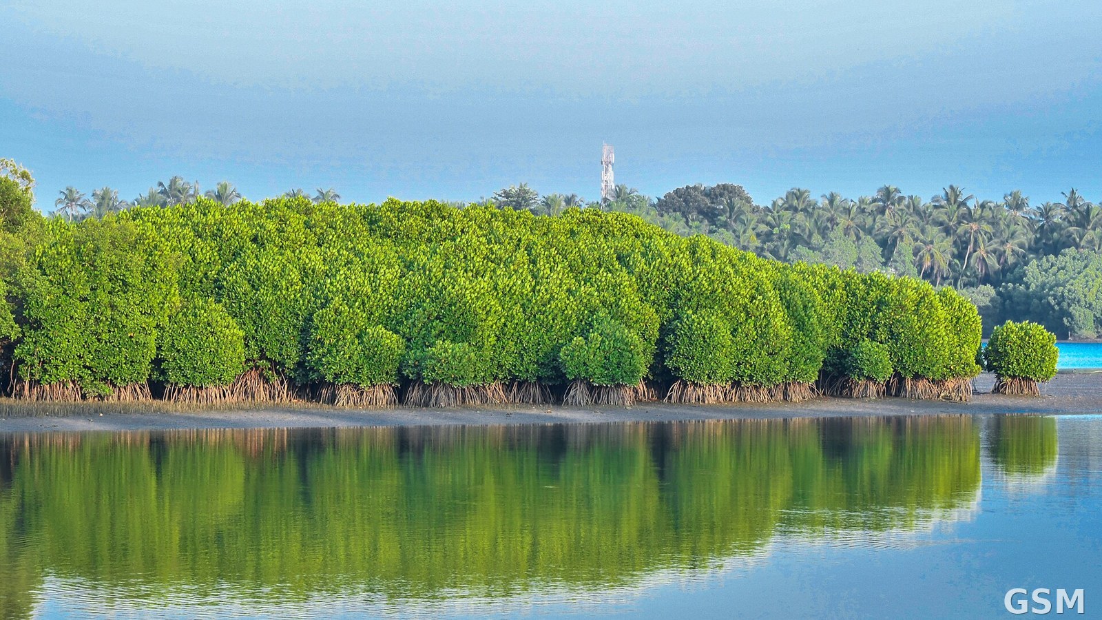
图片来源:图:红树林林带与水面倒影(资料图,摄于印度 Kannur)。Shagil Kannur 摄,CC BY 3.0,经 Wikimedia Commons。 / A mangrove forest and its reflection (file photo, Kannur, India). Photo: Shagil Kannur, CC BY 3.0, via Wikimedia Commons.
GSM Global · 本篇英文版 English edition of this story