印度尼西亚塞梅鲁火山一天内六次喷发:火山碎屑流冲下4.5公里、警戒维持三级
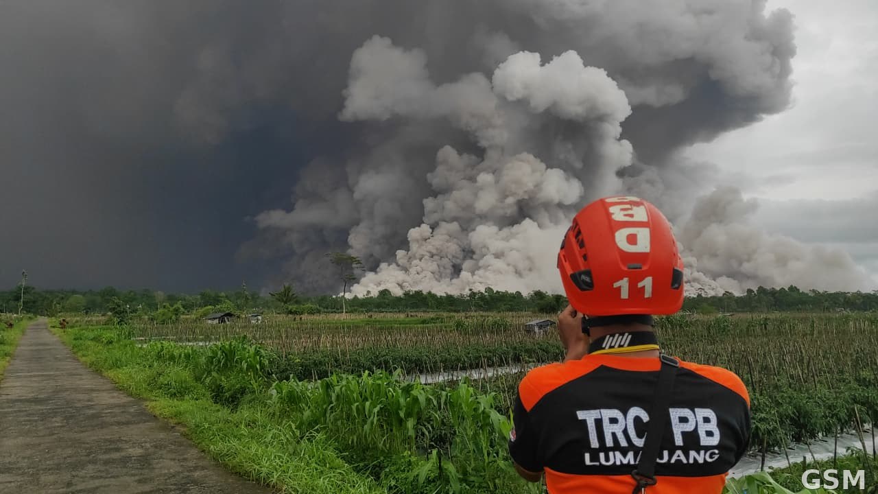
印度尼西亚东爪哇省——位于泗水东南、卢马江县与玛琅县交界处的塞梅鲁火山11月5日自凌晨起连续喷发,一天之内共喷发六次,多股火山碎屑流沿东南坡冲下山体,最远达4.5公里。截至当局发布通报时,未收到人员伤亡或财产损失报告。
塞梅鲁火山海拔3,676米,是爪哇岛最高峰,也是印度尼西亚最活跃的火山之一。据塞梅鲁火山观测站官员 Sigit Rian Alfian 的书面报告,当天清晨6时33分的一次喷发中,火山灰柱升至山顶上方约700米(海拔约4,376米),地震仪记录的最大振幅为22毫米、持续约3分44秒,并伴随一股火山碎屑流向东南方向的 Besuk Kobokan 河谷冲下约3公里。
当天更早的3时33分与5时37分已发生喷发;上午8时42分与9时24分又各有一次,其中9时24分的喷发灰柱同样高约700米、呈灰黑色浓密状,地震仪最大振幅达31毫米、持续约7分27秒。东爪哇省灾害管理局行动控制中心负责人 Muhammad Amrul 表示,截至当天中午已记录到三股火山碎屑流,滑动距离在3公里至4.5公里之间,山脚一带采砂工人一度紧急撤离。
印度尼西亚火山与地质灾害减灾中心维持塞梅鲁火山三级警戒(Siaga,为四级制中的第二高级别),要求卢马江与玛琅两县居民提高警惕、远离东南侧危险区及可能发生火山泥流的河谷地带,并以该中心与地方灾害管理局的官方信息为准。
塞梅鲁火山本月初活动已明显增强:11月4日清晨曾喷发并伴随火山碎屑流;11月1日至2日强降雨还曾引发冷熔岩流(火山泥流)沿 Glidik 河而下,卢马江县117户家庭一度与外界隔绝,所幸无人丧生。此次连续喷发后,当局仍在持续监测山体活动。
(来源:印度尼西亚火山与地质灾害减灾中心)
Indonesia's Mount Semeru Erupts Six Times in One Day: Pyroclastic Flows Race 4.5 Kilometers as Alert Stays at Level III
East Java, Indonesia — Mount Semeru, on the border of Lumajang and Malang regencies in East Java Province, erupted repeatedly from the early hours of November 5, erupting six times in a single day. Several pyroclastic flows raced down its southeastern slopes, the longest reaching 4.5 kilometers. As of the authorities' announcements, no casualties or property damage had been reported.
At 3,676 meters, Semeru is the highest peak on Java and one of Indonesia's most active volcanoes. According to a written report by Sigit Rian Alfian, an officer at the Mount Semeru observation post, an eruption at 6:33 a.m. local time sent an ash column about 700 meters above the summit (about 4,376 meters above sea level); seismographs recorded a maximum amplitude of 22 millimeters over about 3 minutes 44 seconds, and a pyroclastic flow traveled about 3 kilometers southeast toward the Besuk Kobokan river valley.
Eruptions had already occurred at 3:33 a.m. and 5:37 a.m., with further eruptions at 8:42 a.m. and 9:24 a.m. The 9:24 a.m. eruption produced another ash column of about 700 meters, gray to black and thick, with a maximum amplitude of 31 millimeters lasting about 7 minutes 27 seconds. Muhammad Amrul, head of the operations control center of the East Java disaster management agency, said three pyroclastic flows had been recorded by noon, traveling between 3 and 4.5 kilometers, and sand miners near the mountain fled to safety.
Indonesia's Center for Volcanology and Geological Hazard Mitigation (PVMBG) kept Semeru at Alert Level III (Siaga), the second-highest of four levels, urging residents of Lumajang and Malang to stay vigilant, keep away from the southeastern danger zone and from river valleys prone to lahars, and follow official information from PVMBG and local disaster agencies.
Semeru's activity had already intensified earlier this month: it erupted with a pyroclastic flow on the morning of November 4, and heavy rain on November 1-2 sent a cold lahar down the Glidik River that cut off 117 families in Lumajang, though no lives were lost. Authorities continue to monitor the volcano after the latest eruptions.
(Source: Indonesia's Center for Volcanology and Geological Hazard Mitigation (PVMBG))
来源:印度尼西亚火山与地质灾害减灾中心
发布:GSM·美国(发布链接)
图片来源:图:印度尼西亚东爪哇省塞梅鲁火山喷发(资料图,2025年11月19日喷发)。公共领域,经 Wikimedia Commons。 / Photo: Mount Semeru erupting in East Java, Indonesia (file photo, November 19, 2025 eruption). Public domain, via Wikimedia Commons.
GSM Global · 本篇英文版 English edition of this story