国家气象局高浪警报持续至11月2日:欧胡岛北岸浪高15至20英尺
夏威夷州檀香山县檀香山市的美国国家气象局檀香山办公室发布的高浪警报继续生效:一波中等强度的长周期西北涌浪抵达夏威夷多岛,警报从11月1日周日上午6时持续至11月2日周一晚6时。
警报覆盖尼豪岛、考艾岛和欧胡岛的北岸与西岸,以及莫洛凯岛和毛伊岛的北岸;其中北岸浪高预计达到15至20英尺,西岸浪高10至14英尺。涌浪在11月1日夜间迅速增强,周日全天维持在警报级别,周一仍将持续。
气象部门表示,受涌浪影响的海滩将出现强劲的拍岸浪和强流,下水游泳有危险,民众应听从海洋安全官员的建议。警报还提醒船只注意近岸海况变化。
(来源:美国国家气象局檀香山办公室)
High Surf Advisory in Effect Through November 2: Oahu North Shore Surf Building to 15-20 Feet
A high surf advisory from the National Weather Service office in Honolulu, Honolulu County, Hawaii, remains in effect as a moderate, long-period northwest swell reaches the islands. The advisory runs from 6 a.m. Sunday, November 1, to 6 p.m. Monday, November 2.
It covers the north and west facing shores of Niihau, Kauai and Oahu, and the north facing shores of Molokai and Maui. Surf is expected to build to 15 to 20 feet on north facing shores and 10 to 14 feet on west facing shores. The swell built quickly overnight on November 1, holds at advisory levels through Sunday and continues into Monday.
The weather service says exposed beaches will see strong breaking waves and strong currents that make swimming dangerous, and urges beachgoers to heed all advice from ocean safety officials. Boaters are also advised to watch nearshore conditions.
(Source: National Weather Service, Honolulu)
来源:美国国家气象局檀香山办公室
发布:GSM·美国(发布链接)
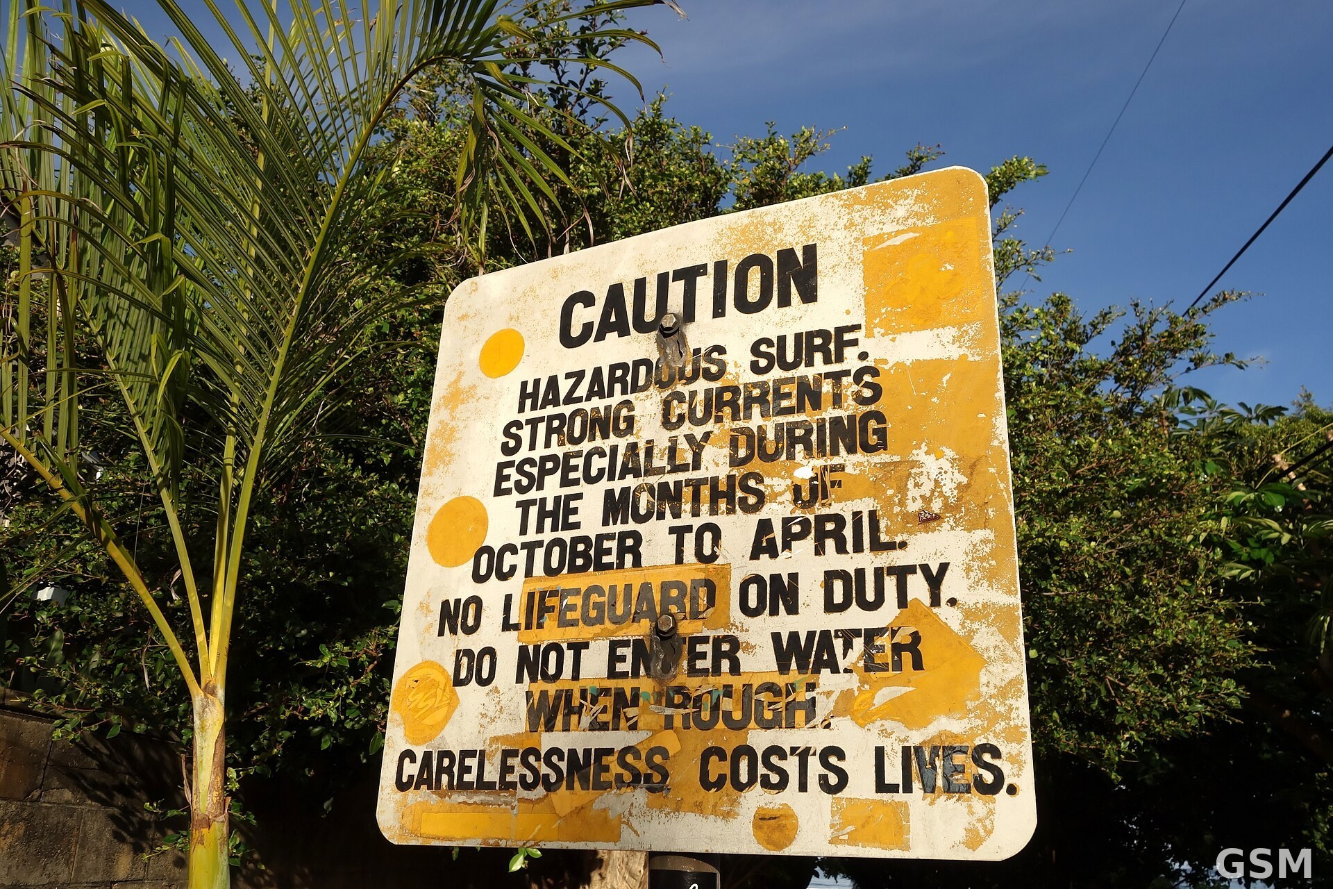
图片来源:图:欧胡岛北岸高浪危险警示牌。Daniel Ramirez 摄,CC BY 2.0,经 Wikimedia Commons。 / Photo: A hazardous surf warning sign on Oahu's North Shore. By Daniel Ramirez, CC BY 2.0, via Wikimedia Commons.
GSM Global · 本篇英文版 English edition of this story