跟进:大潮洪水警告周日生效 橙县与San Diego县潮位或达8英尺 Metrolink下周停开海岸段
美国国家气象局(National Weather Service)San Diego 办公室发布的沿海洪水警告将于10月25日(周日)凌晨5时生效,持续至10月29日(周四)下午1时,覆盖加州橙县与 San Diego 县沿海地区。气象局预计,两县将出现显著沿海洪水,低洼地带的房产会被海水淹没,清晨时段还可能出现海岸侵蚀;计入异常偏暖海水的影响后,潮位预计达到7.5至8英尺甚至更高,可能打破两县的现代潮位纪录。
本站10月23日报道,位于加州橙县的 Newport Beach 市议会10月19日宣布进入本地紧急状态并启动应急行动中心,应对10月26日至28日的 King Tides(大潮)。据 Newport Beach 市政府公布的修正潮位预期,该市最高潮位预计出现在周一(26日)上午9时15分、约8.3英尺,周二(27日)上午9时50分、约8.5英尺,周三(28日)上午10时28分、约8.4英尺,比不计暖海水因素的天文潮预测高出约1.8英尺。当地实际水位近来持续比天文潮预测高约1.25至1.75英尺。
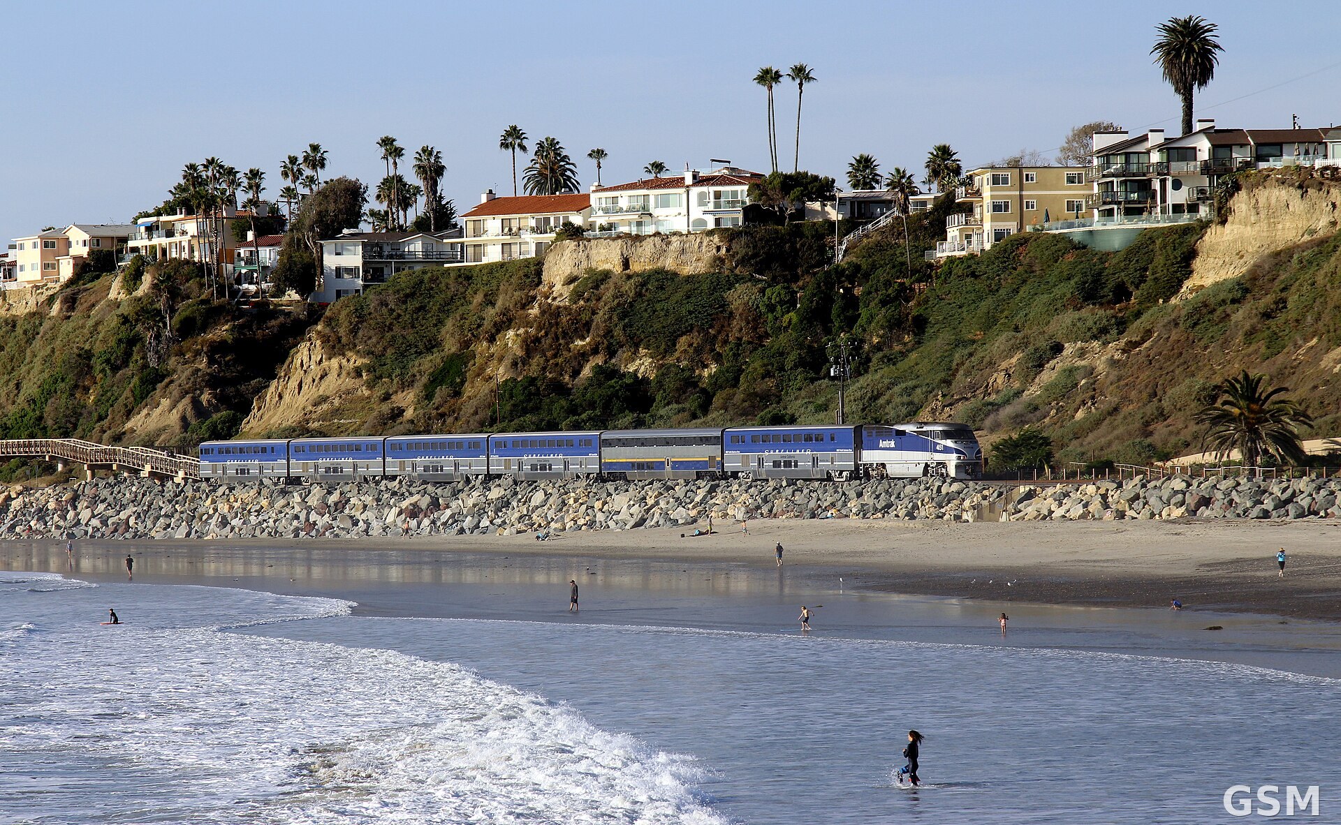
铁路交通将率先受影响。Metrolink 在其官方服务通告中表示,因预报的高潮位,橙县线10月26日(周一)至30日(周五)将不在 Laguna Niguel/Mission Viejo 站与 Oceanside 站之间运行,列车改为在 Laguna Niguel/Mission Viejo 站始发终到,停运区间不提供替代巴士服务;受影响的 San Juan Capistrano、San Clemente 与 Oceanside 三站平日每天各有三个往返班次。Metrolink 表示,将安排合资格人员频繁巡查该路段,并预置人员与设备以应对轨道基础设施可能受到的影响。Amtrak 太平洋冲浪者号(Pacific Surfliner)列车在 San Clemente Pier 与 Oceanside 之间至10月27日可能延误约30分钟,原因包括信号问题与天气状况。
同一时段,洛杉矶(Los Angeles)、Ventura、Santa Barbara 与 San Luis Obispo 四县沿海处于沿海洪水咨询之下,预计出现显著至中度的海滩侵蚀;旧金山湾区与 Monterey 湾区的沿海洪水咨询自周六上午持续至周四下午,近岸与潮汐水道一带地面以上的淹没水深最高约1.9英尺。
各沿海城市正加紧备灾。据《洛杉矶时报》报道,Newport Beach 每天出动30至40辆卡车,从 Prado Dam 一带向 The Wedge 运沙筑堤,目标是在周六前运送2000立方码沙子,并在 Balboa Island 易涝地段堆放了数千个沙袋;Long Beach 已开始疏浚 Alamitos Bay 并向半岛海滩泵沙,受损的木板路也已开始修复;加州交通局(Caltrans)在 Crystal Cove 的 Coast Highway 坡面裂缝下方放置了4英尺高的沙障,靠悬崖一侧的两条车道保持关闭。湾区方面,Highway 37 的一段路本周末将封闭55小时,进行应急加高工程。
据《洛杉矶时报》报道,Scripps 海洋研究所研究员 Reinhard Flick 表示,水位以这样的幅度、持续这么长时间高于预测,据其所知前所未有;国家海洋和大气管理局(NOAA)海洋学家 Doug George 表示,这些警告与咨询都是真实的,目前的条件确实有利于洪水发生,公众应认真对待。
Follow-Up: Coastal Flood Warning Takes Effect Sunday as King Tides Near 8 Feet; Metrolink to Suspend Coast Service Next Week
A Coastal Flood Warning issued by the National Weather Service office in San Diego takes effect at 5 a.m. Sunday, October 25, and runs through 1 p.m. Thursday, October 29, covering the Orange County and San Diego County coasts in California. The weather service expects significant coastal flooding in both counties, with low-lying property inundated and some shoreline erosion possible during the morning hours. Adjusted for unusually warm ocean water, tides are forecast to reach 7.5 to 8 feet or higher and could break modern tide records in both counties.
As GSM reported on October 23, the Newport Beach City Council, in Orange County, California, declared a local emergency on October 19 and activated its Emergency Operations Center ahead of the October 26-28 king tides. According to the city's adjusted tide outlook, Newport Beach expects its highest tides on Monday (Oct. 26) at 9:15 a.m. at about 8.3 feet, Tuesday (Oct. 27) at 9:50 a.m. at about 8.5 feet, and Wednesday (Oct. 28) at 10:28 a.m. at about 8.4 feet - roughly 1.8 feet above astronomical predictions that do not account for the warm ocean water. Actual water levels along the coast have recently been running about 1.25 to 1.75 feet above predicted tides.
Rail service will be among the first casualties. In its official service advisory, Metrolink said that because of the forecast high tides, Orange County Line trains will not operate between the Laguna Niguel/Mission Viejo and Oceanside stations from Monday, October 26, through Friday, October 30; trains will instead originate and terminate at Laguna Niguel/Mission Viejo, and no alternate bus transportation will be provided on the suspended segment. The three affected stations - San Juan Capistrano, San Clemente and Oceanside - normally see three trains a day in each direction. Metrolink said qualified personnel will conduct frequent inspections of the segment and that crews and equipment will be staged to respond to potential impacts on track infrastructure. Amtrak's Pacific Surfliner trains may be delayed by about 30 minutes between the San Clemente Pier and Oceanside through October 27 because of signal issues and weather conditions.
During the same period, a coastal flood advisory covers Los Angeles, Ventura, Santa Barbara and San Luis Obispo counties, where significant to moderate beach erosion is expected. A coastal flood advisory for the San Francisco Bay Area and Monterey Bay runs from Saturday morning through Thursday afternoon, with inundation of up to about 1.9 feet above ground level possible near shorelines and tidal waterways.
Coastal cities are racing to prepare. According to the Los Angeles Times, Newport Beach is running 30 to 40 trucks a day hauling sand from the Prado Dam area to build protective berms at The Wedge, aiming to deliver 2,000 cubic yards by Saturday, and has placed thousands of sandbags in flood-prone parts of Balboa Island. Long Beach has begun dredging Alamitos Bay and pumping sand onto the Peninsula beach, and repairs to its damaged boardwalk have begun. Caltrans has placed 4-foot-tall sand-filled barriers beneath Coast Highway at Crystal Cove, where a crack has developed in the slope, and the two lanes closest to the cliff remain closed. In the Bay Area, a section of Highway 37 will close for 55 hours this weekend for emergency work to raise the flood-prone roadway.
According to the Los Angeles Times, Reinhard Flick, a researcher at the Scripps Institution of Oceanography, said water levels running this far above prediction for this long are, as far as he knows, unprecedented. Doug George, an oceanographer with the National Oceanic and Atmospheric Administration (NOAA), said the warnings and advisories are real and that conditions are favorable for flooding, urging the public to take them seriously.
来源:GSM·美国(原文链接)
图片来源:沿加州橙县 San Clemente 海岸行驶的 Amtrak 太平洋冲浪者号列车,下周停开路段即沿此海岸线(资料图)。照片:Prayitno 摄,CC BY 2.0,经 Wikimedia Commons。 / An Amtrak Pacific Surfliner train along the San Clemente coast in Orange County, California, the stretch where service will be suspended next week (file photo). Photo: Prayitno, CC BY 2.0, via Wikimedia Commons.
- 2026-10-23 16:54Newport Beach 宣布本地紧急状态:迎 10 月 26 至 28 日 King Tides 大潮,三处地点可领免费沙袋
- 2026-10-24 04:26跟进:大潮洪水警告周日生效 橙县与San Diego县潮位或达8英尺 Metrolink下周停开海岸段本篇