跟进:强台风薔琵达巅峰:基隆、宜兰暴风侵袭率62% 气象署估最快周三深夜发海上警报
台北——今年第29号台风「薔琵」持续增强并达巅峰。据交通部中央气象署(气象署 CWA)10月20日清晨2时的资料,强烈台风薔琵中心气压910百帕,中心位置在北纬15.4度、东经136.6度,即鹅銮鼻东南东方约1,800公里海面上,以每小时25公里速度向西北西移动;中心附近最大风速每秒55米,相当于16级风,瞬时最大阵风每秒68米;七级风暴风半径250公里,十级风暴风半径120公里。气象署预测,薔琵10月21日清晨2时将移至鹅銮鼻东南东方约1,200公里海面。
气象署同日发布的120小时台风暴风圈侵袭机率显示,基隆市与宜兰县同以62%居最高,台北市与花莲县为56%,新北市55%,桃园市51%,另有多个县市超过三成。气象署10月18日发布的同一指标中,花莲县、绿岛、兰屿以38%居首,本次北台湾多县市的侵袭机率明显上升。
警报时程方面,气象署表示,最快周三(10月21日)深夜发布海上台风警报,陆上台风警报可能在周四(10月22日)晚间至周五(10月23日)清晨发布;但台风路径不确定性仍高,若台风偏东移动,发布陆上警报的机率较小。本站10月18日曾报道,气象署当时评估薔琵逼近时程较早;依最新资料,警报时程较先前预估稍晚,台风强度则已达巅峰。
天气影响方面,气象署指出,周四起东北季风及台风外围环流影响,北部及东北部天气稍凉,新竹以北及东北部地区有短暂阵雨,其中东北部及大台北山区有局部较大雨势发生的机率,东部地区有局部短暂阵雨。周五、周六台风或其外围环流影响,北部、东北部及东部地区有阵雨,并有局部大雨或豪雨发生的机率。气象署提醒,薔琵接近台湾的过程中强度会逐渐减弱,但仍属强烈台风,所挟带风雨不可小觑,民众应密切留意最新预报与警报资讯。
Severe Typhoon Champi Peaks: Storm-Circle Odds Reach 62% for Keelung and Yilan, Sea Warning Possible Late Wednesday
TAIPEI — Typhoon Champi, the 29th named storm of the year, has strengthened to its peak intensity as it moves across the western Pacific. According to the Central Weather Administration (CWA), at 2 a.m. on October 20 the severe typhoon had a central pressure of 910 hPa and was centred at 15.4°N, 136.6°E — about 1,800 kilometres east-southeast of Eluanbi, Taiwan's southernmost point — moving west-northwest at 25 km/h. Maximum sustained winds near the centre reached 55 metres per second, with gusts of 68 m/s; the radius of gale-force winds extended 250 km and that of storm-force winds 120 km. The CWA forecast Champi to be about 1,200 km east-southeast of Eluanbi by 2 a.m. on October 21.
In the CWA's 120-hour storm-circle probability outlook released the same day, Keelung City and Yilan County topped the list at 62 percent, followed by Taipei City and Hualien County at 56 percent, New Taipei City at 55 percent and Taoyuan City at 51 percent, with several other counties and cities above 30 percent. The probabilities for northern Taiwan have risen markedly from the October 18 outlook, when Hualien, Green Island and Orchid Island led at 38 percent.
On warning timing, the CWA said a sea typhoon warning could be issued as early as late Wednesday night (October 21), with a land warning possible between Thursday night (October 22) and early Friday (October 23). The track remains uncertain, however, and if the typhoon veers east, the chance of a land warning would fall. GSM reported on October 18 that the CWA then expected an earlier approach; the latest data point to a slightly later warning timetable, with the storm now at peak strength.
From Thursday, the northeast monsoon and the typhoon's outer circulation will bring cooler weather and showers to northern and northeastern Taiwan, with locally heavy rain possible in the northeast and the mountains around greater Taipei. On Friday and Saturday, the typhoon or its circulation is expected to bring rain to the north, northeast and east, with a chance of heavy or torrential downpours in places. The CWA said Champi will gradually weaken as it approaches Taiwan but will remain a severe typhoon, and urged the public to follow the latest forecasts and warnings.
来源:GSM·美国(原文链接)
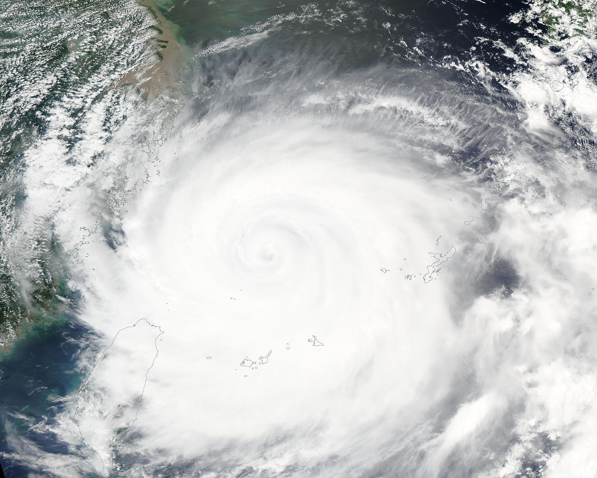
图片来源:台风卫星云图(资料图)。照片:NASA GSFC MODIS快速反应团队/Wikimedia Commons(公共领域)。Satellite image of a typhoon over the western Pacific (file photo). Photo: MODIS Land Rapid Response Team, NASA GSFC / Wikimedia Commons (public domain).
- 2026-10-17 07:23台风Champi逼近关岛:台风警告生效、总督下令全岛进入最高戒备 海岸警卫队关闭港口
- 2026-10-17 07:48跟进:台风Champi急升为四级台风 持续风速约130英里 预计周日清晨以约150英里风速掠过关岛南端
- 2026-10-17 17:07跟进:特朗普批准北马里亚纳群岛紧急声明 台风Champi逼近 FEMA统筹联邦救灾援助
- 2026-10-17 20:23跟进:特朗普批准关岛紧急声明 热带风暴Champi引发紧急状况 FEMA开放联邦救灾援助
- 2026-10-18 02:45台风「尚皮」最后时刻西转擦过关岛南端电力系统避免全面崩溃灾情评估进行中
- 2026-10-18 18:19跟进:台风 Champi 料周二进入菲律宾责任区 PAGASA 警告吕宋岛北部或挂三至四号风讯
- 2026-10-18 20:31跟进:强台风「薔琵」路径仍存变数 天文台料香港本周后期天气转不稳定
- 2026-10-18 20:35跟进:强台风薔琵逼近 气象署估最快周二晚发海上警报、周三晚不排除陆上警报
- 2026-10-20 10:17跟进:强台风薔琵达巅峰:基隆、宜兰暴风侵袭率62% 气象署估最快周三深夜发海上警报本篇
- 2026-10-23 00:39台风「薔琵」掠过台湾东北近海:10月23日几乎全台停班停课,数百航班取消
- 2026-10-23 02:15台风「薔琵」逼近台湾跟进:已致1人死亡、163人受伤 逾2600人疏散、近千个航班取消