Solano县Vacaville以东「Hay Fire」过火10英亩:前进火势已被阻截
位于加州索拉诺县 Vacaville 以东的植被火「Hay Fire」当日燃起、当日被阻截。加州消防局(CAL FIRE)官方事故页显示,这场火于10月20日中午12时02分在 Hay Road 与 Dally Road 一带燃起,过火面积10英亩,由 Vacaville 消防保护区管辖;事故页正文未列控制率百分比,CAL FIRE 事故列表页显示为0%。
据事故页更新,下午1时12分,CAL FIRE 派出一名营级指挥官、4台消防车、2台推土机、2支地面队伍、1架直升机、2架灭火飞机与1架空中指挥机协助处置;下午1时33分,事故指挥部报告,这场火的前进火势已被阻截。参与处置的机构还包括 Vacaville 消防局、Fairfield 消防局、Dixon 消防局与 Montezuma 消防保护区。据 KION Central Coast 报道,火势在下午12时50分前后扩至约8至10英亩、响应升至四级火警,截至下午1时45分未有人员受伤或建筑受损的报告。
官方事故页未发布疏散令或疏散警告,事故页最后更新为下午1时45分;起火原因仍在调查中。
Hay Fire Burns 10 Acres East of Vacaville in Solano County; Forward Progress Stopped
SOLANO COUNTY, California — The Hay Fire, a vegetation fire east of Vacaville in Solano County, California, broke out and was stopped on the same day. CAL FIRE's official incident page shows the fire started at 12:02 p.m. on Tuesday, October 20, near Hay Road and Dally Road, and burned 10 acres; it is under the jurisdiction of the Vacaville Fire Protection District. The incident page itself displays no containment percentage, while CAL FIRE's incidents list shows 0%.
According to the incident page updates, at 1:12 p.m. CAL FIRE was assisting at the incident, sending a battalion chief, four engines, two dozers, two crews, one helicopter, two air tankers and one air attack aircraft; at 1:33 p.m., Incident Command reported that forward progress of the fire had been stopped. Also responding were the Vacaville Fire Department, the Fairfield Fire Department, the Dixon Fire Department and the Montezuma Fire Protection District. KION Central Coast reported the fire had grown to about 8 to 10 acres by around 12:50 p.m., prompting a fourth alarm, with no injuries or structural damage reported as of 1:45 p.m.
No evacuation orders or warnings were posted on the official incident page, which was last updated at 1:45 p.m.; the cause remains under investigation.
发布:GSM·美国(发布链接)
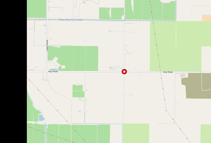
图片来源:图:Hay Fire 位置示意图(GSM 据加州消防局 CAL FIRE 官方事故页公布的起火地点 Hay Road 与 Dally Road 一带绘制,红点为报告起火位置一带)。底图 © OpenStreetMap contributors。最新官方数据以正文为准。 Location map of the Hay Fire, drawn by GSM from the ignition area published on CAL FIRE's official incident page (near Hay Road and Dally Road, east of Vacaville); the red marker shows the reported ignition area. Base map © OpenStreetMap contributors. The latest official figures are in the text.
GSM Global · 本篇英文版 English edition of this story