Ventura县Ojai以西爆发「Ranch Fire」 Watch Duty标注约0.25英亩 消防与空中力量投入扑救
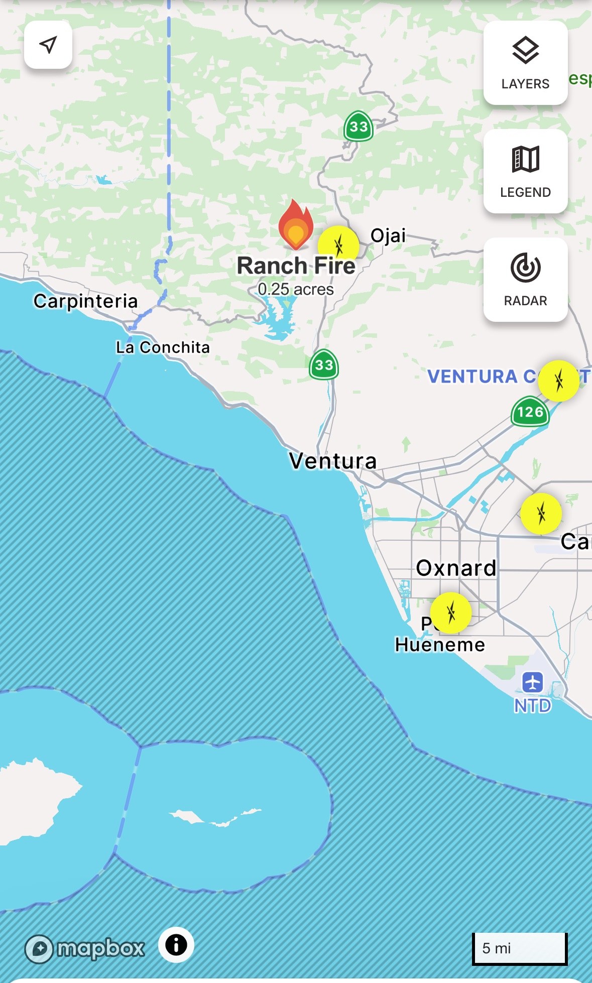
Ventura县——加州 Ventura 县 Ojai 以西 10 月 19 日(周一)下午爆发一场灌木野火「Ranch Fire」。据联邦跨机构事故系统(IRWIN)记录,这场火于下午 2 时 01 分被报告,起火点位于 Ojai 以西、Lake Casitas 以北的 Ranch Road 1900 号街区一带,靠近 Casitas Pass 与 33 号公路。Watch Duty 态势图在下午 3 时 52 分标注火场约 0.25 英亩;截至发稿,官方尚未公布控制率,也未见疏散令或疏散警告发布。
这场火的主管机关为 Ventura 县消防局,加州消防局(CAL FIRE)等力量参与处置。据当地媒体 Ojai Valley News 在现场拍摄的画面,灭火飞机在火场上空投放阻燃剂、直升机投水,地面消防员沿山坡铺设水带、扑打余火。起火原因尚未确定。
火场周边为山地灌木地带与零散住宅,Ojai 与 Lake Casitas 一带居民可留意 Ventura 县消防局与 Watch Duty 的后续通报。
Ranch Fire Breaks Out West of Ojai in Ventura County; Watch Duty Maps About 0.25 Acres as Ground and Air Crews Respond
VENTURA COUNTY — A brush fire dubbed the Ranch Fire broke out west of Ojai in Ventura County, California, on the afternoon of Monday, October 19. According to the federal Interagency Initial Attack system (IRWIN), the fire was reported at 2:01 p.m., near the 1900 block of Ranch Road west of Ojai and north of Lake Casitas, close to Casitas Pass and Highway 33. Watch Duty mapped the fire at about 0.25 acres as of 3:52 p.m.; officials had not released a containment figure, and no evacuation orders or warnings had been issued as of publication.
The Ventura County Fire Department is the agency having jurisdiction, with CAL FIRE among the assisting agencies. Video recorded at the scene by the Ojai Valley News showed air tankers dropping retardant over the fire, a helicopter making water drops, and ground crews laying hose lines along the slope and working hot spots. The cause of the fire has not been determined.
The fire is burning in hilly brush country dotted with rural homes; residents around Ojai and Lake Casitas should watch for further updates from the Ventura County Fire Department and Watch Duty.
发布:GSM·美国(发布链接)
图片来源:图:Ranch Fire 态势图,Watch Duty 截图(美西时间10月19日15时52分截取)。火点位于 Ojai 以西、Lake Casitas 以北,图中标注的 0.25 英亩为 Watch Duty 数据;官方尚未公布过火面积与控制率,最新数据以官方通报为准。图片来源:Watch Duty。Situation map of the Ranch Fire, Watch Duty screenshot taken at 3:52 p.m. PDT on Oct. 19. The fire sits west of Ojai and north of Lake Casitas; the 0.25-acre label is Watch Duty data, and officials have not yet released acreage or containment figures. Source: Watch Duty.
GSM Global · 本篇英文版 English edition of this story