加州发布湾区—三角洲水质计划修订最终稿 10月28日至29日开会表决
Sacramento——加州水资源控制委员会(State Water Resources Control Board)10月16日发布Sacramento河及三角洲流域水质控制计划(通称「湾区—三角洲计划」)修订的最终稿。委员会定于10月28日至29日在Sacramento加州环保局大楼(1001 I Street)开会审议表决,公众可线上观看会议直播并发表口头意见。
本次发布的最终稿覆盖Sacramento河流域、三角洲东侧三条支流——卡拉维拉斯河(Calaveras)、科苏姆尼河(Cosumnes)与莫克勒米河(Mokelumne)——以及三角洲地区。委员会称,最终稿以8月18日发布的版本为基础,根据9月18日截止前收到的书面意见作了澄清性小幅修改,实质内容变动不大。
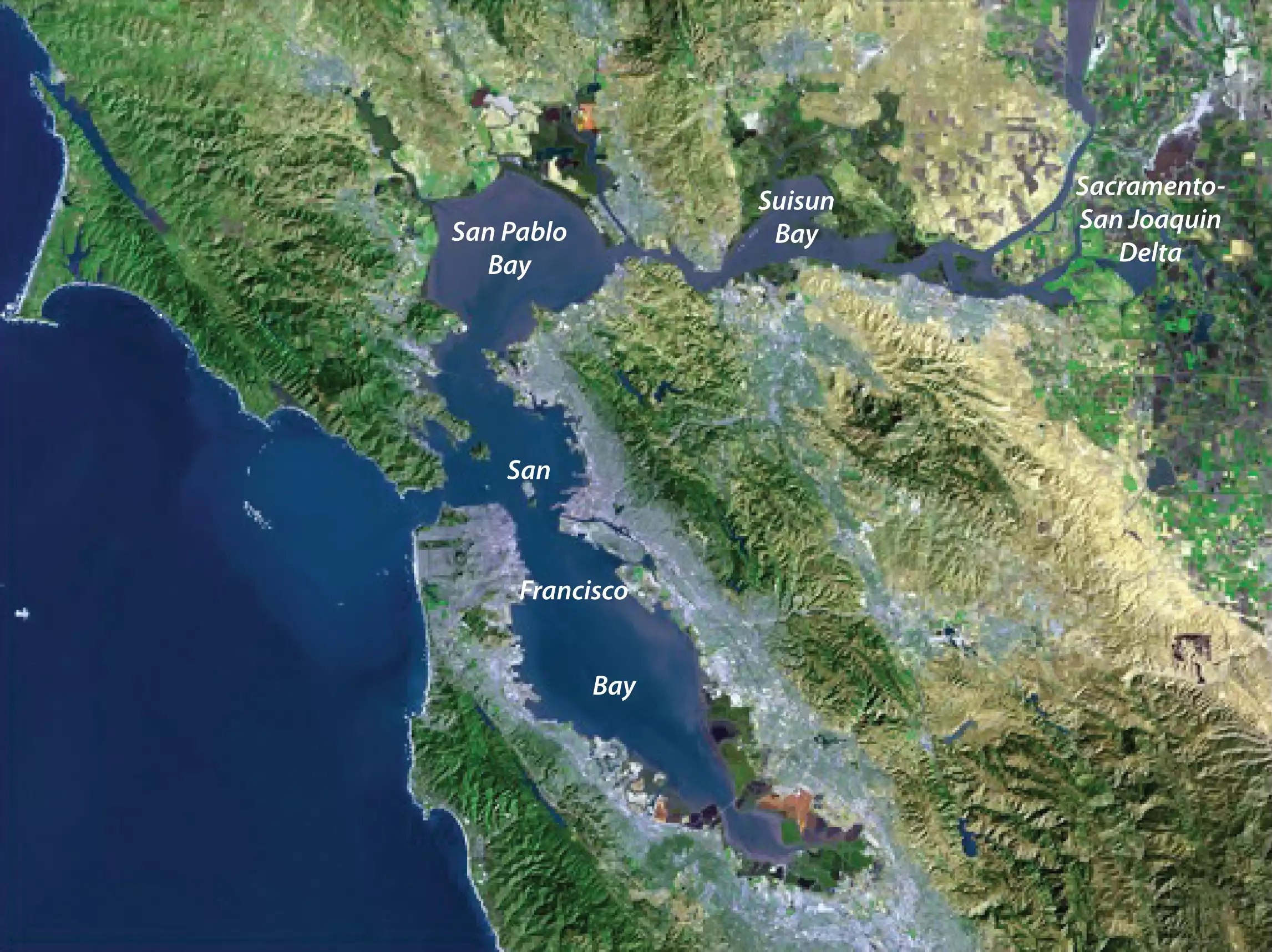
湾区—三角洲计划是加州管理其最大河口水质与水流的核心规划文件。Sacramento—圣华金三角洲是全州水系枢纽:其供水惠及近3000万加州居民和400万英亩农田,同时是数百种鱼类与野生动物的栖息地。委员会表示,修订旨在让该计划反映最新的科学与信息。
修订终稿同时保留了「自愿协议」路径:用水方可通过「健康河流与土地计划」(Healthy Rivers and Landscapes)提出流量与栖息地承诺,作为达到计划目标的替代实施方式。
(来源:加州水资源控制委员会)
California Releases Final Bay-Delta Plan Update; Board Vote Set for Oct. 28-29
SACRAMENTO — The State Water Resources Control Board on October 16 released the final draft of its update to the Water Quality Control Plan for the Sacramento River and Delta watershed, commonly known as the Bay-Delta Plan. The board is scheduled to meet October 28-29 at the CalEPA Building, 1001 I Street in Sacramento, to consider adopting the update; the public can watch the meeting online and offer oral comments.
The final draft covers the Sacramento River watershed, the three eastside tributaries to the Delta — the Calaveras, Cosumnes and Mokelumne rivers — and the Delta itself. The board said the final version makes clarifying, non-substantive changes to the draft released August 18, based on written comments received through September 18.
The Bay-Delta Plan is California's core framework for water quality and flows in the state's largest estuary. The Sacramento-San Joaquin Delta supplies water to nearly 30 million Californians and 4 million acres of farmland and is home to hundreds of fish and wildlife species. The board said the update is intended to reflect the latest science and information.
The final draft also retains a Voluntary Agreements pathway, under which water users can offer flow and habitat commitments through the Healthy Rivers and Landscapes program as an alternative way to meet the plan's objectives.
(Source: State Water Resources Control Board)
来源:加州水资源控制委员会
发布:GSM·美国(发布链接)
图片来源:图:旧金山湾与萨克拉门托—圣华金三角洲卫星图(美国国家航空航天局、美国地质调查局)。Satellite image of San Francisco Bay and the Sacramento-San Joaquin Delta. (NASA/USGS)
GSM Global · 本篇英文版 English edition of this story