飓风“西蒙”增强为四级直扑墨西哥太平洋岸,曼萨尼约与巴亚尔塔港一带发飓风警报
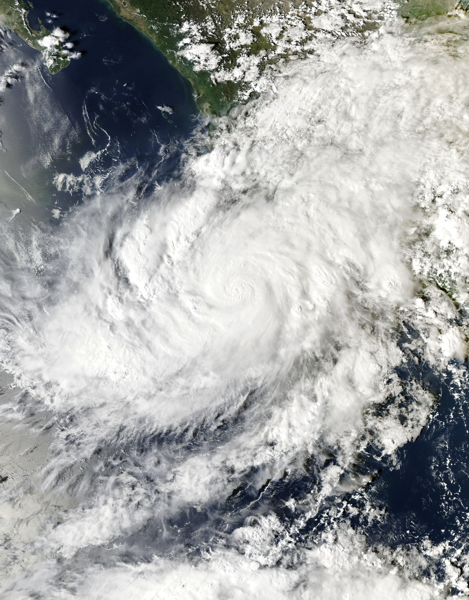
飓风“西蒙”(Simon)10 月 10 日(周六)在墨西哥太平洋近海迅速增强为四级飓风。美国国家飓风中心(NHC)周六晚间的最新数据显示,其最大持续风速已升至约每小时 155 英里(约 250 公里),距五级仅一步之遥;其中心位于曼萨尼约西南南约 65 英里(约 105 公里)处,以约每小时 5 英里向北缓慢移动,较晚间早些时候明显靠近海岸。预计周日以强飓风强度在墨西哥中西部海岸登陆,登陆前仍可能略有增强,登陆点预计在哈利斯科州 La Huerta 至 Tomatlán 一带沿海。
警报范围:巴亚尔塔港(Puerto Vallarta)以南的墨西哥太平洋沿岸部分地区已发布飓风警报,涵盖曼萨尼约周边以及近海的玛丽亚群岛(Islas Marías);更南至 Lázaro Cárdenas 一带发布热带风暴观察。NHC 提醒警报区居民尽快完成防灾准备。墨西哥民防部门宣布,自周六下午 4 时起,巴亚尔塔港及哈利斯科、科利马、米却肯、纳亚里特多地暂停非必要活动与出行。
主要威胁是暴雨与洪涝:NHC 预计至周日,墨西哥西南部部分地区降雨 250 至 500 毫米,米却肯、科利马、哈利斯科局部可达约 750 毫米,山区可能引发危及生命的洪水与泥石流;登陆点附近及以东海岸将有风暴潮与破坏性大浪,未来几天墨西哥西南与中西部沿海还有危险激流。气象分析指出,“西蒙”增强速度异常快,正是这类风暴危险之处——留给沿岸社区的准备时间被大幅压缩。上周,飓风 Polo 刚以二级强度登陆下加利福尼亚半岛,造成树木与电线杆倒伏、街道被淹,当地灾后恢复尚未结束。
对 GSM 读者:巴亚尔塔港、曼萨尼约都是南加华人熟悉的度假与邮轮停靠地,近期有赴当地旅行或有亲友在当地者,请密切留意 NHC 与墨西哥民防的最新公告,避免在警报期前往海滩与低洼地区。后续看点为实际登陆位置与强度、港口与机场运行中断情况,以及灾情与救援进展。
Hurricane Simon Strengthens to Category 4 Off Mexico's Pacific Coast; Landfall Expected Late Saturday or Early Sunday Near Manzanillo–Puerto Vallarta Stretch
Hurricane Simon strengthened into a Category 4 storm off Mexico's Pacific coast on Saturday, Oct. 10. In its latest Saturday-night update, the U.S. National Hurricane Center reported maximum sustained winds near 155 mph, just shy of Category 5, with its center about 65 miles south-southwest of Manzanillo, moving north at about 5 mph — noticeably closer to shore than earlier in the evening. Simon is expected to make landfall on Mexico's west-central coast on Sunday as a major hurricane, with landfall expected along the Jalisco coast between La Huerta and Tomatlán, and some further strengthening is possible beforehand.
A hurricane warning covers parts of the Pacific coast south of Puerto Vallarta, including the Manzanillo area and the offshore Islas Marías, with a tropical storm watch farther south toward Lázaro Cárdenas. Mexican civil protection authorities suspended nonessential activities and travel from 4 p.m. Saturday in Puerto Vallarta and municipalities across Jalisco, Colima, Michoacán and Nayarit.
The NHC expects 10 to 20 inches of rain across portions of southwestern Mexico through Sunday, with isolated totals up to about 30 inches in parts of Michoacán, Colima and Jalisco — enough to trigger life-threatening flooding and mudslides, especially in mountainous terrain — plus storm surge and destructive waves near and east of the landfall point. AccuWeather meteorologists noted Simon intensified unusually fast, compressing preparation time for coastal communities. The storm follows Hurricane Polo, which hit the Baja California Peninsula as a Category 2 last week.
For GSM readers: Puerto Vallarta and Manzanillo are familiar vacation and cruise destinations for Southern California Chinese; anyone traveling there soon or with family there should monitor the latest NHC and Mexican civil protection bulletins and avoid beaches and low-lying areas during the warning period. What to watch next: the actual landfall location and intensity, port and airport disruptions, and damage and rescue updates.
图片来源:NOAA Aqua 卫星 MODIS 影像(2026-10-09),公有领域(Wikimedia Commons)