Rachel 今晚登陆下加州:圣迭戈迎史上第二次热带风暴观察,夜间暴雨山洪威胁升级
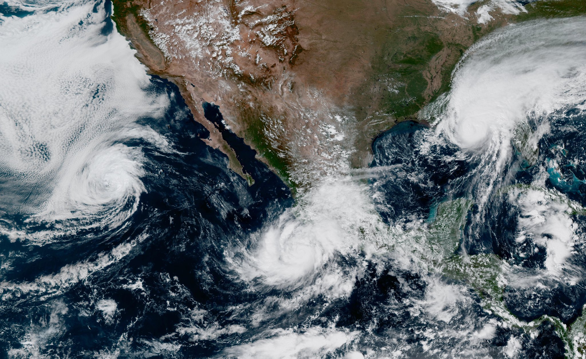
热带风暴 Rachel 周六晚起对南加州的影响进入关键阶段。气象部门预计,风暴将于周六晚间至周日凌晨在墨西哥下加州北部登陆,登陆点在圣迭戈以南。截至周六上午,Rachel 最大持续风速约 60 英里/小时,风圈半径约 150 英里,国家飓风中心预计它在周日深入内陆后迅速减弱、转为后热带气旋。
圣迭戈目前处于热带风暴观察之下——这是该地区有记录以来第二次发出此类观察,上一次是 2023 年的飓风 Hilary。国家气象局把周六晚到周日从南加州到内华达南部、犹他西南部和亚利桑那西北部的洪水降雨威胁定为 4 级中的 3 级,预计出现多起山洪事件。圣迭戈和拉斯维加斯的降雨量可能超过 1 英寸,相当于圣迭戈整个 10 月正常降雨量的两倍、拉斯维加斯的三倍,沙漠地区难以快速吸收短时强降雨,山洪风险最高。
风力方面,今晚到周日南加州阵风可达 39 至 57 英里/小时。圣迭戈低地阵风 25 至 40 英里/小时、山区 50 至 70 英里/小时,峰值出现在周日凌晨,气象局提醒棚屋、车棚、无锚定活动房屋可能受损,树枝折断和小型树木倒伏会导致路障或停电。河滨县的 Coachella 谷周六晚 11 点至周日晚上 8 点发布洪水观察,气象局称沙漠地区每小时雨量可达 0.5 至 0.7 英寸、山区 0.7 至 1 英寸,降水高峰在周六深夜到周日下午。
洛杉矶和橙县海岸面临另一重威胁。洛杉矶与橙县的海岸洪水警告持续到周日下午 3 点,随后橙县转为海岸洪水咨询至周二下午 2 点。周日上午高潮位期间,海岸线洪水、沙滩侵蚀和脆弱海岸结构受损风险很高。洛杉矶县周日上午 6 点至晚 10 点还有高浪警告,浪高 4 至 7 英尺、橙县部分海滩达 9 英尺,离岸流危险。南加州周末总雨量预计 0.25 至 1 英寸,圣加布里埃尔山东侧山区可能更高。
气象局敦促居民不要驾车穿越积水路段、绕行路障,今晚尽量留在室内。周日下半天还有一股较冷的低压系统进入,带来第二轮分散阵雨和明显降温,圣迭戈和内陆高温将明显回落。各县应急部门建议居民清理院落排水、收好户外物品,并关注国家气象局和地方政府的最新警报更新。
Tropical Storm Rachel to Make Landfall Tonight; San Diego Under Rare Tropical Storm Watch as Flash Flood Threat Rises
Tropical Storm Rachel's impacts on Southern California enter a critical phase Saturday night. Forecasters expect the storm to move onshore in northern Baja California just south of San Diego early Sunday morning. As of Saturday morning, Rachel's maximum sustained winds were around 60 mph with tropical-storm-force winds extending about 150 miles from the center; the National Hurricane Center expects rapid weakening after it moves inland on Sunday, becoming post-tropical by Sunday morning.
San Diego is under a tropical storm watch, only the second time on record such a watch has been issued for the area, the first being Hurricane Hilary in 2023. The National Weather Service has set the flooding-rainfall threat at Level 3 of 4 from Saturday night through Sunday across parts of Southern California to southern Nevada, southwest Utah and northwest Arizona, with numerous flash flood events expected. San Diego and Las Vegas could see more than an inch of rain — about double the entire October average for San Diego and triple for Las Vegas — raising flash-flood risk in desert areas that cannot absorb intense bursts of rainfall.
Winds are expected to gust 39 to 57 mph across Southern California through tonight and Sunday. In and around San Diego, gusts of 25 to 40 mph are expected in lower elevations and 50 to 70 mph in the mountains early Sunday morning; the NWS warns that sheds, carports and unanchored mobile homes could be damaged, with downed tree limbs and debris on roads, and possible power outages. A flood watch is in effect for the Coachella Valley from 11 p.m. Saturday to 8 p.m. Sunday, with hourly rainfall rates of 0.5 to 0.7 inches possible across deserts and 0.7 to 1 inch per hour across mountains, heaviest late Saturday night through early Sunday afternoon.
Los Angeles and Orange counties face a coastal threat as well. A coastal flood warning for LA and Orange counties runs through 3 p.m. Sunday, followed by a coastal flood advisory for Orange County through 2 p.m. Tuesday. The risk of significant shoreline flooding, beach erosion and damage to vulnerable coastal structures is high during morning high tides. A high surf advisory is in effect for the LA County and Malibu coasts from 6 a.m. to 10 p.m. Sunday, with breaking waves of 4 to 7 feet and sets up to 9 feet in Orange County, creating dangerous rip currents. Total rainfall across Southern California is expected to range from a quarter-inch to an inch, with higher totals possible in mountain corridors like the eastern San Gabriel Mountains.
The weather service urges residents not to drive through flooded roads or around barricades and to stay indoors Saturday night. A second, colder low-pressure system arrives late Sunday into Monday, bringing additional scattered showers and noticeably cooler temperatures. County emergency agencies advise residents to clear yard drains, secure outdoor items, and monitor the latest alerts from the National Weather Service and local authorities.
图片来源:GOES-East 卫星云图(2026-10-09),公有领域(Wikimedia Commons)